Geoscience Reference
In-Depth Information
A
B
C
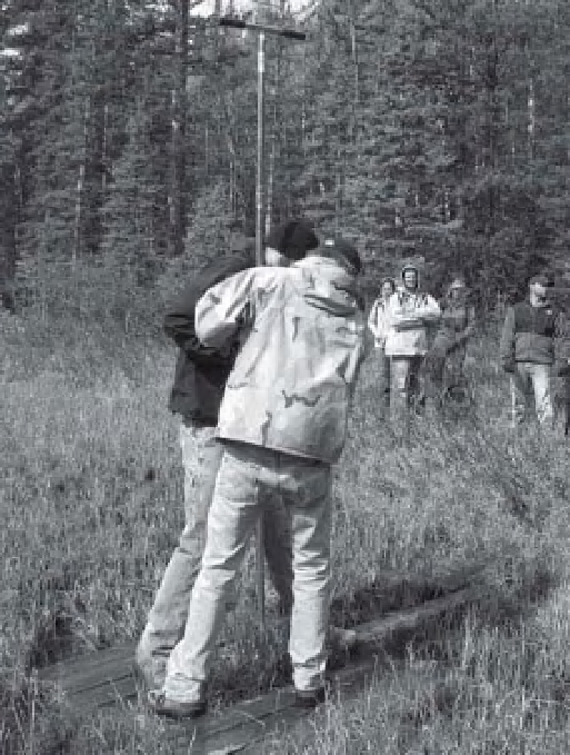
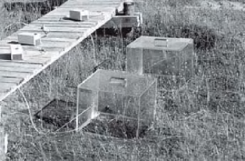
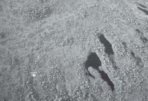
Figure 3-31.
Platforms for mire research. A. Temporary wooden pallet laid around a peat coring site on a watery
subalpine fen in Colorado, United States. Photo by J.S. Aber. B. Aerial view of raised wooden boardwalk (*) in
Männikjärve Bog, Estonia. Note foot trail leading to the boardwalk from the lower left corner; the boardwalk is
∼
10 m long. This platform is reserved for scientii c research and is not open to the public. Kite airphoto by J.S. Aber
and S.W. Aber. C. Flux chambers with tubes and battery-driven pumps to collect samples of gas emitted from the
bog at the research boardwalk shown in B. Image courtesy of P. Frenzel (Frenzel and Karofeld 2000).
rate of plant migration, competition between
plants through time, and early human impact on
vegetation (Iversen 1973).
Power drilling equipment or geophysical
instruments are necessary in the deeper subsur-
face. Direct-push drilling, such as Geoprobe, is
a good way to collect samples, prepare monitor-
ing wells, and conduct well logging tens of
meters deep in unconsolidated sediments typical
of most wetlands (Fig. 3-34). Geophysical tech-
niques with potential for use in wetlands include
the transient electromagnetic (TEM) method and
ground-penetrating radar (GPR). Both are suit-
able for shallow subsurface investigations in
unconsolidated sediment.
TEM is based on the response of subsurface
materials
-
solids and l uids
-
to an electromag-
netic impulse ( Jørgensen, Sandersen and Auken
2003). TEM is done with a transmitter loop car-
rying a steady current (3 A) and a receiving coil
in the center of the loop. The ground response
is measured when the transmitted signal is
turned off for brief intervals (9
μ
s to 9 ms). The
sampling may be done in a discrete grid pattern
or along a continuous proi le. Depth of penetra-
tion varies from 100 to 300 m, and spatial resolu-
tion spreads out with greater depth. TEM has
proven valuable for investigating buried valleys
and their aquifers; for example in Denmark ( Jør-
gensen et al. 2005).
GPR has become relatively common for
shallow-subsurface prospecting and mapping
purposes. Short pulses of high-energy micro-
waves are transmitted from the surface into the