Environmental Engineering Reference
In-Depth Information
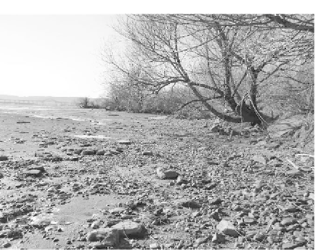
FIGURE 2.3 Low Water Levels in Lake Superior: View of Duluth-Superior
Harbor Looking Toward the High Bridge, 2007
Source:
Jeff Gunderson/Minnesota Sea Grant.
The vast High Plains aquifer underlies portions of eight states,
providing water for these major food-producing areas. But the
ancient aquifer is being depleted. In fact, one of the great water
wars of the future will be over the High Plains/Ogallala because
people have overpumped it for years, says the U.S. Department of
Agriculture's Brad Rippey. In some parts of the aquifer—areas of
northwestern Texas, the Oklahoma panhandle, and southwestern
Kansas—water levels are down more than 150 feet. Total water stor-
age in 2005 in the aquifer was about 2,925 million acre-feet. (One
acre-foot of water generally is enough for a family of four for a year.)
That's down 253 million acre-feet, or 9 percent, since farmers began
tapping the aquifer to meet their irrigation needs around 1950.
25
Portions of the aquifer in west-central Kansas already are
exhausted, adds Don Whittemore, senior scientifi c fellow at the