Travel Reference
In-Depth Information
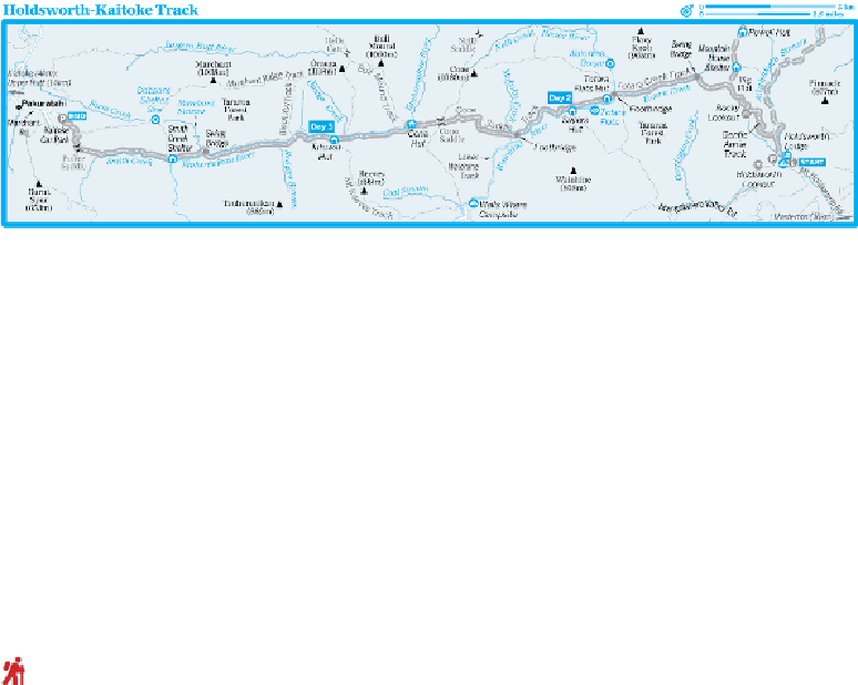
open, unmarked, alpine ridge routes. Following the Waiohine and Tauherenikau rivers
between Holdsworth and Kaitoke, this low-level tramp gains a maximum of 740m in alti-
tude along a track that is well marked and signposted at every junction.
Although it can be tramped in either direction, it is most commonly started at
Holdsworth.
8
Planning
WHEN TO TRAMP
This tramp can be done year-round.
MAPS
This tramp is covered by
NZTopo50 BP33
(Featherston) and
BP34
(Masterton).
HUTS & CAMPING
Huts en route are Totara Flats and Tutuwai, both of which are
Serviced Huts
the huts ($5), and at suitable sites along the tracks such as Totara Flats, for free.
The Tramp
Day 1: Holdsworth Lodge to Totara Flats Hut
4-5 HOURS, 12KM
The track departs the lodge west, on a wide gravel path, crosses a footbridge over
Ati-
whakatu Stream
and passes a track (left) to Holdsworth Lookout (30 minutes away).
Another junction lies 200m further on.