Travel Reference
In-Depth Information
Nabq National Park
. This
coastal park on the edge of
the desert boasts crystal-clear
lagoons and the most northerly
mangrove forest in the world,
which extends for 4 km (2.5
miles) along the shoreline.
The hardy mangroves are able
to live in salt water, making
this is an extremely important
environment, linking land to
sea. It is used as a feeding
ground by migratory birds,
including storks, herons and
many species of birds of prey.
Ras Muhammad
National Park
5
Road map
E7. 20 km (12.5 miles) S
of Sharm el-Sheikh.
k @
to Sharm
el-Sheikh, then taxi.
#
daily.
& 8
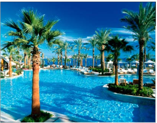
Four Seasons Resort, one of numerous luxury hotels in Sharm el-Sheikh
most famous and dangerous
are the “Canyon” and the
“Blue Hole”. Almost entirely
surrounded by reef, the Blue
Hole drops to a depth of 80 m
(260 ft) only a few metres off
the shore. Although many sites
are for expert scuba divers
only, there are still plenty of
others suitable for beginners
or snorkellers.
as well as scuba divers out
to the open sea. Here, in
the Strait of Tiran, you can
observe manta rays, sharks,
dolphins and, occasionally,
sea turtles. For those wanting
to stay above water, tourists
are taken in glass-bottomed
boats to observe the coral reef
from above. Other attractions
include all manner of water
sports, plus camel treks,
quad biking and
excursions inland.
Another spectacular
sight is the long
reef under the cliffs
to the west of the
Ras Umm Sidd
lighthouse.
Reachable from
land, here you
can admire a
forest of gorgonians, huge
Napoleon fish and, some-
times, barracuda.
On the southern tip of the
Sinai peninsula, where the
waters of the Gulf of Suez
and the Gulf of Aqaba
converge, is a park instituted in
1983 to protect the incredibly
varied coastal and marine
environment. It
includes extensive
coral reefs, a
lagoon, mangroves
and a rugged desert
coastline, and there
is a series of well-
marked trails
leading to the most
interesting spots.
Among the most
beautiful of these is
the Ras Muhammad
headland, the southernmost
point in Sinai. Formed from
fossilized corals, the headland
is surrounded by beautiful
reefs. The diving sites are very
varied, with both reefs and
wrecks to explore. There are
also long, sandy beaches and a
clifftop “Shark Observatory”.
Sharm el-Sheikh
4
Road map
E7.
k @ n
Tourist
Office, Sharm el-Sheikh, (062) 601 900.
Until relatively recently, the
most famous resort in Sinai
was only a military airport.
Situated on the western side
of the Strait of Tiran, Sharm
became famous when
Egyptian president Nasser
decided to block Israeli
access to the Red Sea, thus
provoking the 1967 war.
Under Israeli occupation of
Sinai, the first hotels were
built and began to attract
tourists, especially expert
scuba divers. The Sharm el-
Sheikh bay is still a military
port, but the neighbouring
Sharm el-Maiya bay has
hotels, shops and small
restaurants. Most of the tourist
development, however, has
focused on
Naama Bay
, a few
kilometres to the north. This
is the place that most people
actually mean when they talk
about Sharm el-Sheikh. It has
a long beach with a host of
luxury hotels and diving
centres. Boats take snorkellers
Gazelle at Ras Muhammad
National Park
Environs
A 29-km (18-mile) journey by
A
jeep along the coast road north
of Sharm el-Sheikh brings you
to the 600-sq km (232-sq mile)
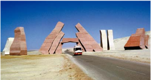
Entrance to Ras Muhammad National Park
Diver exploring coral reef in the Red Sea, surrounded by glittering shoal of sweeper fish