Travel Reference
In-Depth Information
7
Reserva
Provincial Punta
Tombo
Road
map
B4. 68 miles (110 km) S of
Trelew.
Open
Sep-Apr: 8am-8pm
daily.
n
Ruta Provincial 1, S of Trelew,
(02965) 1520-9900.
&
-
∑
puntatombo.com
Easy day trips run daily from
Trelew and Puerto Madryn to
the preserve.
8
Camarones
Road
map
B5. 156 miles (252 km) S of
Trelew.
*
2,200.
@
n
Estrada 467,
(0297) 496-3013.
_
Fiesta Nacional
del Salmón (Feb).
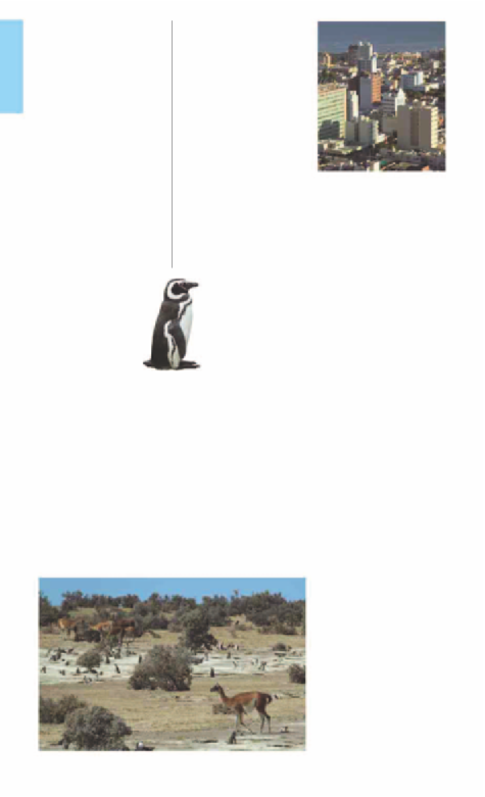
A narrow, stony peninsula that
juts out abruptly into the
Atlantic Ocean, Punta Tombo
harbors South America's largest
colony of Magellanic penguins.
From September to April, over
650,000 of these black and
white birds use the peninsula
to incubate their eggs and
prepare their offspring for
migration. They nest in
scrapes underneath the bushes
and both male and female
penguins take turns to guard
their nests, protecting eggs
from avian predators. These
predators include the giant
petrel as well as various
species of gull, skua,
and cormorant.
These humble
penguins are not as
glamorous as their larger
cousins, the king and
emperor penguins. While they
can be observed from
extremely close quarters,
visitors need to be careful not
to touch them. An ideal time to
visit is between November and
January when there are plenty
of chicks. Apart from these
penguins, several marine bird
species can also be spotted.
The nearby countryside is a
great place to see land fauna,
including Patagonian hares,
guanacos, and greater rheas.
Literally translating into
“shrimps,” Camarones is a small,
picturesque fishing village of
one-story buildings and dusty
streets. Located on the shores
of an eponymous bay, this
village is the main point of
access to
Reserva Provincial
Cabo dos Bahías
. Inaugurated
as a tribute to Juan Perón, the
Museo de la Familia
Perón
exhibits Perón
family memorabilia from
Juan and his brother
Avelino's early youth in
Patagonia. The family first
lived in Río Gallegos, less
than 60 miles (100 km)
north of the Strait of
Magellan, then further
north near Camarones.
Comodoro Rivadavia along the majestic
Golfo San Jorge
9
Comodoro
Rivadavia
Road
map
B5. 229 miles (370 km) S of
Trelew.
*
180,000.
k
@
n
Yrigoyen & Moreno, (0297) 444-0664.
∑
comodoroturismo.gob.ar
Argentina's oil capital and one
of the biggest cities on its
Atlantic coast, Comodoro
Rivadavia is located on the
shores of the majestic
Golfo
San Jorge
and is overlooked by
Cerro Chenque
. Also the leader
in renewable energy, the city is
home to Latin America's biggest
wind farm.
Drilling rigs and storage tanks
can still be seen in the city,
where oil was first struck in
1907. The site can be visited at
Museo Nacional del Petróleo
,
where exhibits trace the
evolution of Argentina's oil
industry. The city's railroad
history is traced at
Museo
Ferroportuario
. The short taxi
ride to Cerro Chenque ends
with breathtaking vistas of Golfo
San Jorge, the city, and the
beaches at the upscale resort of
Rada Tilly
.
A Magellanic
penguin
Environs
About 19 miles (30 km)
southeast of the town is
Reserva Provincial Cabo dos
Bahías, which protects a
12,000-strong colony of
Magellanic penguins. Visitors
can also observe the sea lion
colony on Isla Moreno.
E
Museo de la Familia Perón
Estrada 467.
Te l
(0297) 496-3014.
Open
9am-7pm Mon-Fri, 2-7pm Sat,
Sun, & hols.
Environs
The eerily silent wind farm,
El
Parque Eólico Antonio Morán
,
is
7 miles (12 km) outside
Rada Tilly.
E
Museo Nacional del Petróleo
Carlos Calvo & San Lorenzo, Barrio
General Moscón, Km 3.
Te l
(0297) 455-
9558.
Open
9am-5pm Tue-Fri,
3-6pm Sat, Sun, & hols.
&
8
Spanish only.
E
Museo Ferroportuario
Ave Rivadavia & 9 de Julio.
Te l
(0297)
444-4874.
Open
9am-5pm daily.
Guanacos in the Reserva Provincial Punta Tombo
For hotels and restaurants see pp278-83 and pp288-99