Travel Reference
In-Depth Information
color. Guided descents
into the canyons take
about 3 or 4 hours. For
less ambitious hikers,
there is a relatively
easy nature trail that
skirts the canyon rim
while passing cacti,
aloes, and shrubs. A
more ambitious hike
follows the canyon
rim south for about
half an hour, and has
better views from
higher cliffs.
In addition to its
natural appeal, Las
Quijadas also has
numerous archaeo-
logical sites. Between
the park entrance and
Aguada, the recently excavated
Hornillos Huarpes
, ovens
where the park's pre-Columbian
peoples fired their ceramics, is a
sight of interest.
w
Parque Nacional
Sierra de las
Quijadas
Road map
B2. 104 miles (167 km) SE
of San Juan.
@
from San Juan & San
Luis.
n
Ecuador 735, (02652) 445-
141; ranger station at park entrance.
Open
8am-5pm daily.
&
8
only
Span ish.
-
∑
parques
nacionales.gov.ar
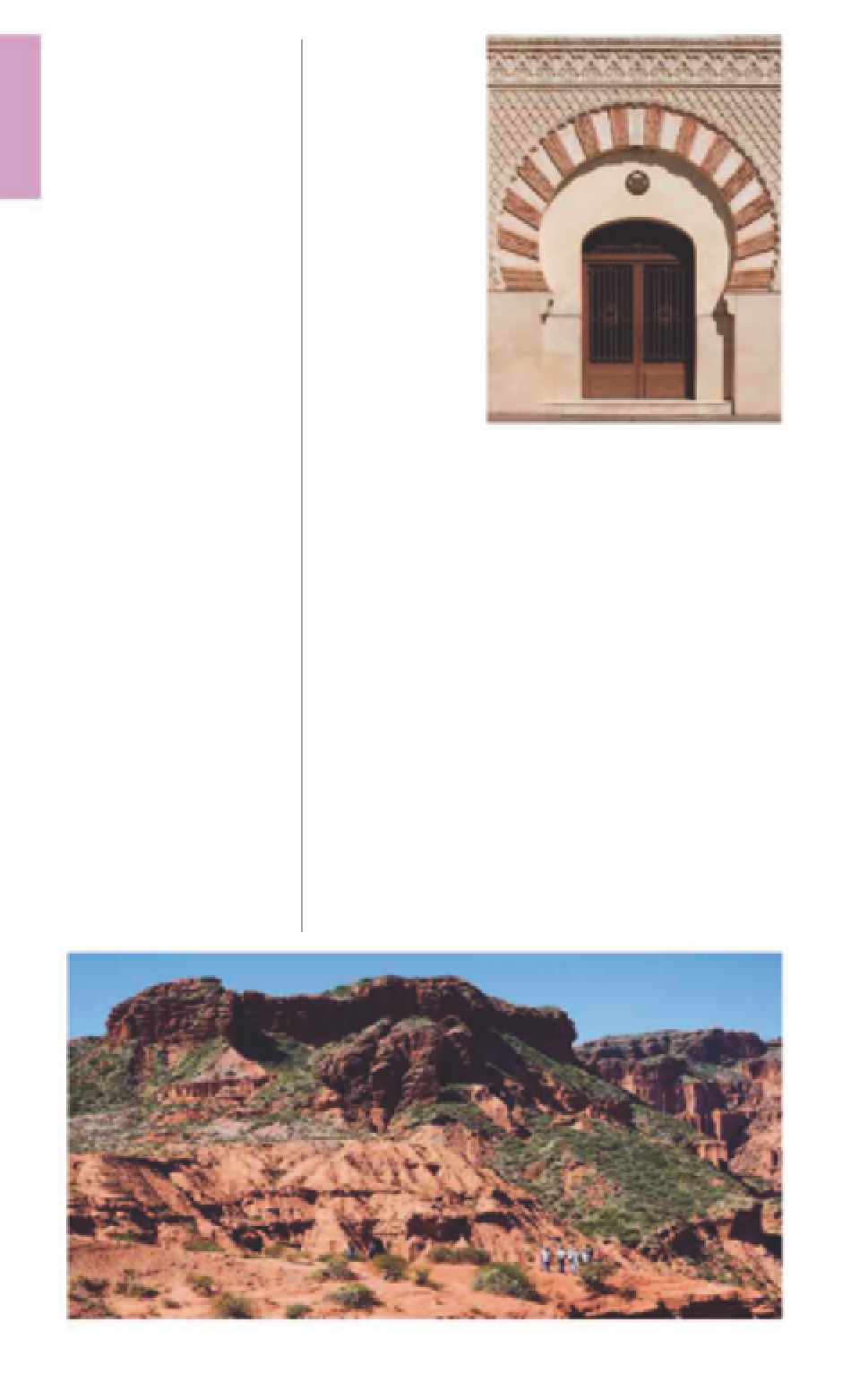
The enormous orange-red
sandstone canyons of Parque
Nacional Sierra de las Quijadas
get far fewer visitors than their
spectacular scenery merits.
A treasurehouse for
paleontologists, this impressive
network of canyons is part of a
northern paleontological circuit
that includes San Juan's
Ischigualasto
(see p221)
and La
Rioja's Talampaya
(see p189)
.
About 120 million years ago,
in the Cretaceous period,
pterosaurs (flying reptiles)
roamed the area freely. A half-
hour hike from the park's
entrance leads to the
Loma del
Pterodaustro
, a fossil-field of
dinosaur remains.
A gravel road leading up a
narrow sedimentary canyon
emerges onto the spectacular
panoramas of the
Potrero de la
Aguada
, which is located about
5 miles (8 km) from the park
entrance. This is a veritable
maze of small canyons leading
to a dry lake bed. Much photo-
graphed, the majestic Aguada is
best enjoyed during sunset
when it takes on a fiery orange
Moorish-style Iglesia de Santo Domingo
a restaurant and bar district.
Four blocks south, also
impressively landscaped, is
Plaza Independencia
, the city's
other central square and home
to
Palacio de Gobierno
, the
provincial government house.
Opposite the plaza is
Iglesia de
Santo Domingo
, a 17th-century
church built in Moorish style.
e
San Luis
Road map
B2. 174 miles (280 km) E of
Mendoza.
*
152,198.
~
@
n
Ave
Illia & Junín, (0266) 442-3479.
∑
sanluis.gov.ar
Environs
Only 12 miles (20 km) northeast
of San Luis is the hill station of
Potrero de los Funes
, where the
capital's residents take a break
with watersports or horse riding
in the nearly roadless Sierra de
San Luis.
Calling itself the Gateway to
Cuyo, San Luis is a tidy provincial
capital whose colonial grid
contains attractive public spaces
such as
Plaza Pringles
. This is the
center of the city, dominated by
the Neo-Classical
Iglesia Catedral
with its twin bell towers and
elaborately sculpted pediment.
To the northwest is Avenida Illia,
R
Iglesia Catedral
Pringles and Rivadavia.
Te l
(0266) 442-4414.
Open
daily.
The red rocks of the Potrero de la Aguada, Parque Nacional Sierra de las Quijadas
For hotels and restaurants see pp278-83 and pp288-99