Travel Reference
In-Depth Information
3
Uspallata
Road map
B2. 89 miles (140 km) NW
of Mendoza.
*
3,284.
@
n
junction of Ruta Nacional 7 and Ruta
Provincial 52, (0261) 413-2101.
painted ski resorts.
Set against the
backdrop of the
Andes mountain
range are 26 snow-
dust tracks, ideal for
both professional
and amateur skiers.
The town is also a
base for Aconcagua-
bound hikers and
climbers. Modern ski-
lifts run at weekends
during selected
months for visitors to
enjoy the fabulous valley and
mountain views.
At the headwaters of Río
Mendoza, Uspallata, the biggest
settlement between Gran
Mendoza and the border,
occupies a scenic valley. Its
resemblance to Central Asian
highlands is so striking that the
location was chosen for the
1997 movie
Seven Years In Tibet
,
starring Brad Pitt.
While Uspallata has only a
few sights to explore, several
rafting and kayaking companies
offer trips on the sediment-
clogged Río Mendoza
(see p308)
.
Though it lacks difficult rapids, it
gets big waves during the
spring runoff, which is the best
time for a good kayaking and
rafting experience.
A Los Penitentes ski resort in summer
closed for many years because
of a legal dispute. This route
was the same taken by
Independence hero José de San
Martín's Army of the Andes and
also Charles Darwin a couple
of decades later. To the north,
along Ruta Provincial 39 toward
Calingasta, the
Comunidad
Huarpe Guaytamari
is an
indigenous outpost with
a llama farm and
handicrafts market.
5
Cristo Redentor
Road map
B2. Ruta Nacional 7, near
Las Cuevas.
@
8
-
=
∑
cristoredentorchiar.galeon.com
After Argentina and Chile
resolved one of their
countless border
differences in 1902, the
two countries, under the
auspices of British King
Edward VII, signed a pact
to determine the Andean
boundary between them.
As part of the pact, they
installed a 26-ft (8-m)
statue of Christ, 13,779 ft
(4,200 m) above sea
level. The statue was
made by Uruguayan
sculptor Mateo
Alonso using metal
from cannons and
other weapons. The road
to the saddle where the
statue stands is a vertiginous
zigzag that yields spectacular
panoramas of the Río
Mendoza Valley.
For many years, the old route
to Cristo used to be the main
international highway. It has
since been superseded by a
tunnel, but tour buses and
private cars still transport
visitors to the statue.
However, the road is open
only between January and
March; the rest of the year it
is closed due to heavy snowfall.
When the road is open,
most tours go up to the
17,817-ft (5,430-m)
Cerro
Tolosa
,
where climbers train
to scale Aconcagua.
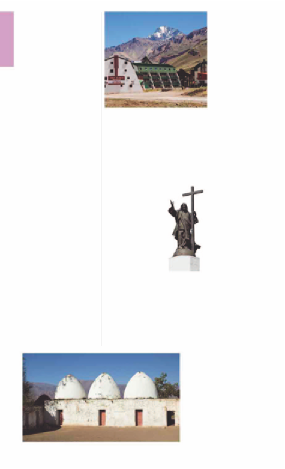
Environs
The surrounding countryside
along Ruta Provincial 52 and
other nearby roads has a cluster
of interesting historic sights.
About 1.2 miles (2 km) west of
Uspallata stand the
Bóvedas
Históricas Uspallata
, white-
washed domed kilns that date
from the 17th century. They
were used for metallurgy even
in pre-Columbian times. A short
distance to the northeast, there
are several beautiful pre-
Columbian petroglyphs and a
shrine to the Mapuche “saint”
Ceferino Namuncurá
(see p29)
at the lava outcrop of
Cerro
Tunduqueral
. Another route to
Mendoza continues via a zigzag
road past the hot springs of
Villavicencio
, which have been
4
Los Penitentes
Road map
B2. Ruta
Internacional 7, Km 163.
n
Ski
Center (0261) 425-5511.
@
0
-
=
®
∑
penitentes.
com.ar
From Uspallata, rugged
roads to the west give
way to spectacular
scenery all the way to
Los Penitentes. At 8,464 ft
(2,580 m) above sea level, Los
Penitentes is the best skiing
option for Mendoza-based
visitors. Better known as Villa
Los Penitentes, the village is
filled with several brightly
Cristo Redentor
statue on the
Chile border
Domed kilns used to smelt metal, Bóvedas Históricas Uspallata
For hotels and restaurants see pp278-83 and pp288-99