Geography Reference
In-Depth Information
Out of proportion
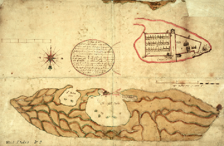
WILLEMSTAD, CURAÇAO, MID TO LATE 17TH CENTURY
This intriguing item is really two maps in one. Its lower half depicts the Caribbean island of
Curaçao, formerly a Dutch colony and now a country within the Kingdom of the Netherlands.
The sliver of land at the top edge is the coast of Venezuela on the South American mainland.
The red-edged shape occupying much of the upper right-hand side is not a second island but
a large inset town plan. This shows Willemstad, the island's capital, drawn at 'ten times ye
bignes' of the main map.
We know little for certain about when and why the map was created. It once belonged to
the Board of Trade and Plantations and was later kept in the map library at the Colonial Of-
fice, where staff tentatively dated it to about 1700. We now think that it could be rather older.
It may have been drawn between 1665 and 1675, during the Second or Third Anglo-Dutch
Wars when military intelligence about Dutch colonies would have been of value to the Eng-