Geography Reference
In-Depth Information
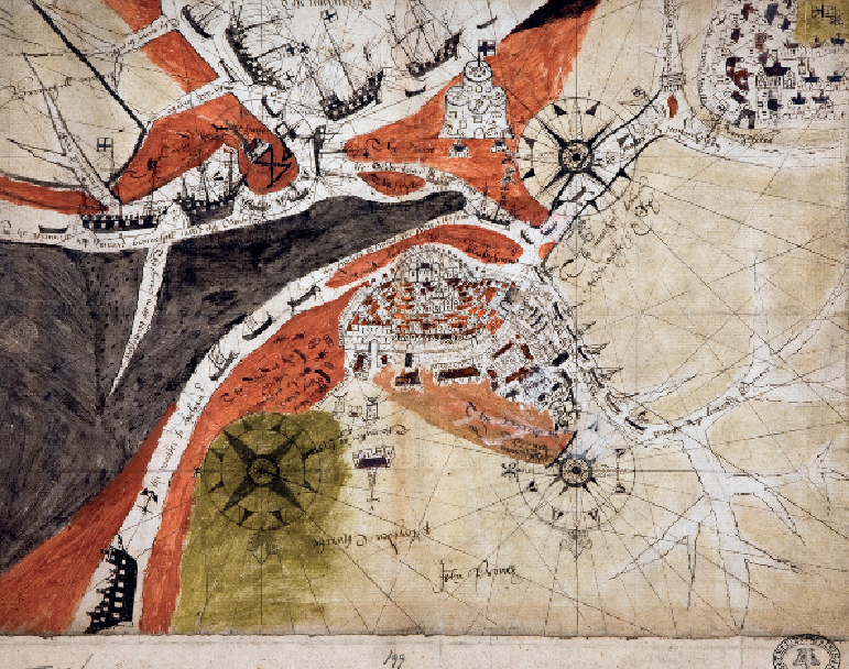
Sea change: a receding coastline
RYE, SUSSEX, 1572
Is this a map or a chart? On paper as in real life the line between land and sea has blurred
edges. What it shows is the town and Cinque Port of Rye at centre, at a pivotal point in its
history. Its heyday was the mid 16th century, but just decades later when this map was made
its fortunes were beginning to wane. Ship traffic was much reduced from 1558 when England
lost her last continental possession, Calais, across the Channel. And the waterways from the
town to the sea (top) were beginning to silt up, beginning the process of stranding the port in-
land, miles from the sea, as now. This meant that ships had to unload goods into boats of less-
er draught to reach the town. Rye was defended from the sea by Camber Castle (top centre),
built by Henry VIII but becoming obsolete as the sea moved away from it, and abandoned a