Geography Reference
In-Depth Information
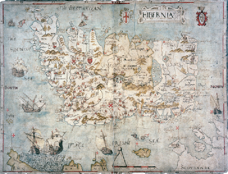
Sea monsters, galleons and misty mountains
IRELAND IN THE 16TH CENTURY
This map shows the island of Ireland, as viewed by statesmen in London. It appears rather
squashed in shape, until we realise that it has west not north at the top; turn the map to the
left to see a more familiar outline. Among the earliest cartographic representations of Ireland,
this map was drawn in 1567, at a time when the Protestant Elizabeth I wanted tighter control
of Ireland to prevent it becoming a prize for her Catholic enemies on the continent. She col-
onised by supplanting the native Irish baronies with 'plantations' given to Englishmen. The
very act of mapping was part of the appropriation of power over land.
Ireland was up to that time uncharted territory from the viewpoint of its remote English
rulers. However, this overview map gives the impression of a land which could be named,