Geography Reference
In-Depth Information
A border line case
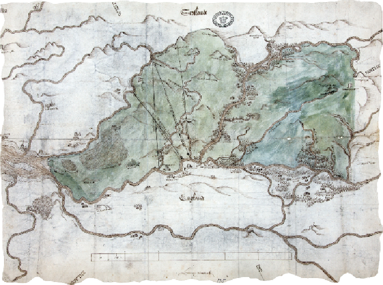
THE DEBATABLE LAND BETWEEN SCOTLAND AND ENGLAND, 1552
When this map was drawn in 1552, England and Scotland were separate countries, their
crowns not united until King James of Scotland succeeded Elizabeth I in 1603. These two
nations were not always peaceable neighbours, so the Anglo-Scottish border needed to be
fixed, especially at the western end, which was a stronghold of lawless clans. This was the
'Debatable Land' between Cumberland and Dumfriesshire, shown in green on this map.
The area was nearly four miles wide, lying between the rivers Sark and Esk, their waters
running into the Solway Firth at left. Gretna is off the map to the left, while Canonbie is at
centre. The map shows a wild land of hills, moors, bogs or mosses, and smaller burns run-
ning off rivers. Note the way that shading is applied outside the hills, as if they have hair.