Geography Reference
In-Depth Information
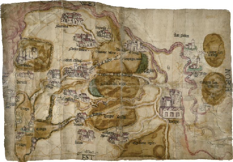
Castles and commons in a Welsh valley
ST BRIDE'S MAJOR, GLAMORGAN BEFORE 1540
This map shows an area of just a few square miles in the Vale of Glamorgan, on the south
coast of Wales; the sea runs along the left edge of the map. When and why was it made? It can
be difficult to date early manuscript maps precisely if there are no papers to which they are
obviously related. One method is to use datable evidence, where something on the map can
be linked to a specific event. This map pictures Ewenny Priory at lower right (to the north,
spelt 'Wenye') looking solid and intact. It was dissolved in early 1540 as part of the Reform-
ation, and much of the building was dismantled. There is also a rare view of Dunraven Castle
to the south (top left) which was demolished and replaced by a manor house at some point in
the 1540s. These features point to a pre-Reformation date for the map.
The map shows much else besides Ewenny Priory and Dunraven Castle. Commons and
downs are coloured brown, the king's wood and another wood shaded green, and roads are