Geography Reference
In-Depth Information
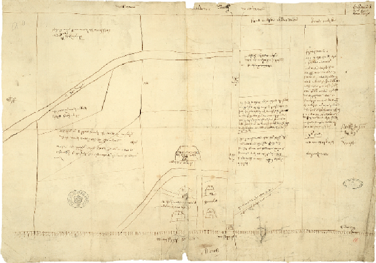
A deserted hamlet
NEAR TUNBRIDGE WELLS, KENT, c.1519
It is wise not to judge a map by its looks. Pen and ink sketch maps like this one are just as
likely to convey useful or interesting information as more attractive creations. Drawn for a
dispute over the lands shown, this small map (less than 40cm by 60cm) incorporates a wealth
of detail, including a county boundary, an otherwise unrecorded deserted hamlet, the text of a
fourteenth-century document about the land, a royal hunting forest of Henry VIII and dower
lands of one of his queens.
Although few of the places named on the map still exist, the area shown was in the vicinity
of what is now Tunbridge Wells, long before the discovery of mineral waters led to the
growth of the spa town in Georgian times. At the top right of the map runs the boundary
between Kent and Sussex. At the lower edge, which is marked 'north', a wavy line indicates
the park pale of Southfrith, a royal deer park. The focus of the map is a group of buildings