Geography Reference
In-Depth Information
An evil empire?
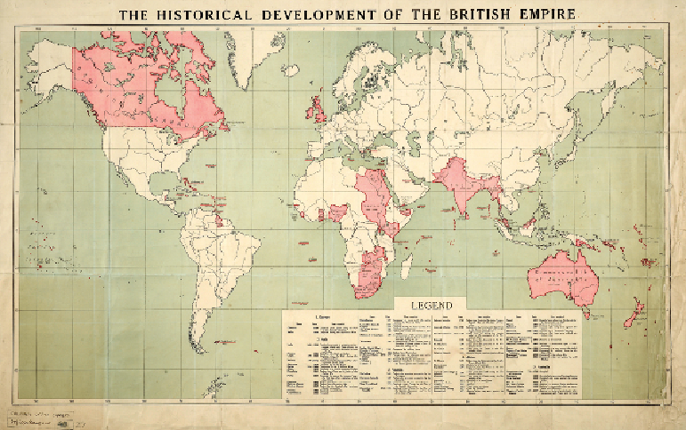
THE BRITISH EMPIRE, 1915
First impressions are not always reliable. Superficially, this map appears to represent the
world as a British schoolchild of the early twentieth century would have been taught to per-
ceive it. The conventional, cylindrical projection creates a rectangular shape, with the Amer-
icas to the viewer's left, Asia to the right, Africa occupying the middle and the United King-
dom in prime position above the centre. The title proclaims the map's subject to be the British
Empire, and the mother country and her colonies are tinted the traditional pink.
This was not, however, a map intended to glorify Britain's imperial power but exactly the
opposite. The first clue to this is that it was published in Berlin in 1915, when the British and
German Empires were engaged on opposing sides in the First World War. Its publisher, Di-
etrich Reimer, was an established company with specialisms in geography, archaeology and
art, whose authoritative reputation would have aided the effectiveness of this item as a piece
of anti-British propaganda.