Geography Reference
In-Depth Information
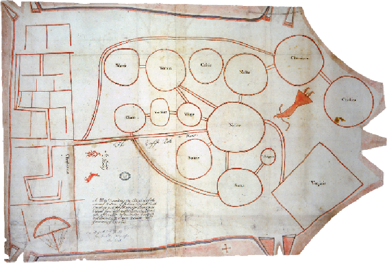
'An Indian a Hunting'
CAROLINA, c.1721
The map behind this map was a 'Draught Drawn & Painted upon a Deer Skin by an Indian
Cacique', as the title of this map tells us. Although this copy of the chief 's map is made
on paper, it has kept the shape of the deerskin, with the animal's neck to the right. This is
one of very few surviving maps from this period which record the topographical distribution
of native Americans in this area. The different peoples are named within circles of varying
size joined by lines, which perhaps indicate roads but may represent the state of relations
between the various nations. Some have multiple links while others have only one. While
circles indicate the Indian areas, straight lines and rectangles are used for places associated
with European colonists; Virginia at lower right, and an early town plan of Charleston at left
on the eastern seaboard. Was this an attempt to distinguish between the natural world of the
Indians and the man-made landscape of the newcomers, perhaps, or simply that these were
places of different sorts of people?