Geography Reference
In-Depth Information
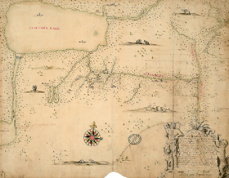
'Journey to the 5 Indian Nations'
IROQUOIS COUNTRY, 1700
There is often little visible difference between early maps made for military reasons and those
concerned with establishing a colony. This map was made by Colonel William Römer, an en-
gineer in the British army, who was sent to New York in 1698 to oversee the fortifications of
the city and province. It shows his journey to the interior of what is now upstate New York,
to survey places for defence against the French, who also wanted to control this area. These
lands to the north-west of New York were largely unmapped by Europeans. They were territ-
ories of the Five Nations, a confederacy of native Iroquois, with whom the British sought an
alliance against the French. Thus the map incorporates aspects of exploration, military intel-
ligence, diplomacy, general topography and much information about the tribes.