Geography Reference
In-Depth Information
Trench warfare
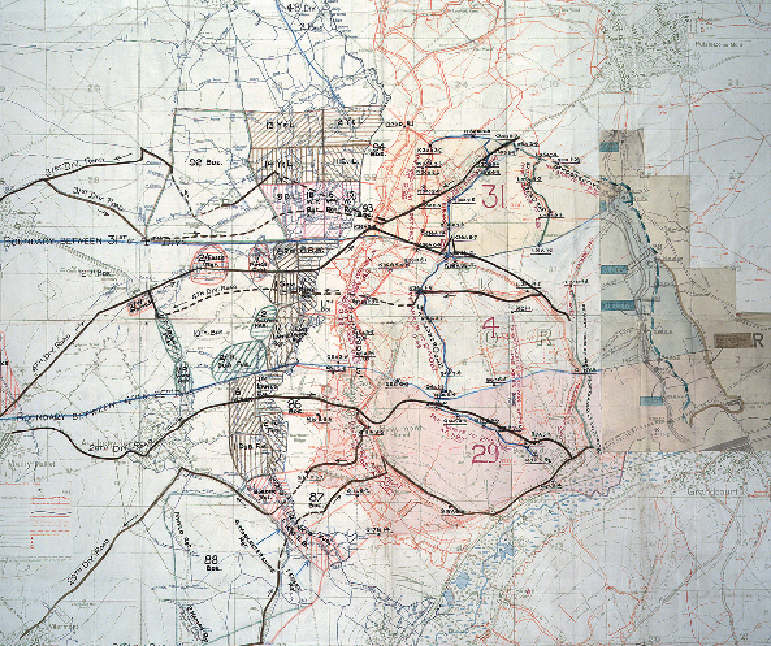
ENVIRONS OF BEAUMONT-HAMEL AND SERRE, FRANCE, 1916
The First World War saw a greater use of mapping for military purposes than any previous
conflict. On the Western Front alone, about 34 million official maps were printed for the
use of the British army. These varied widely in their coverage and purpose, from large-scale
trench maps designed as locational aids to smaller-scale overview maps intended to support
high-level planning and administration. Standard-issue sheets included as much detail as pos-
sible about German trenches (which were normally overprinted in red) but far less about