Geography Reference
In-Depth Information
'Low Land'
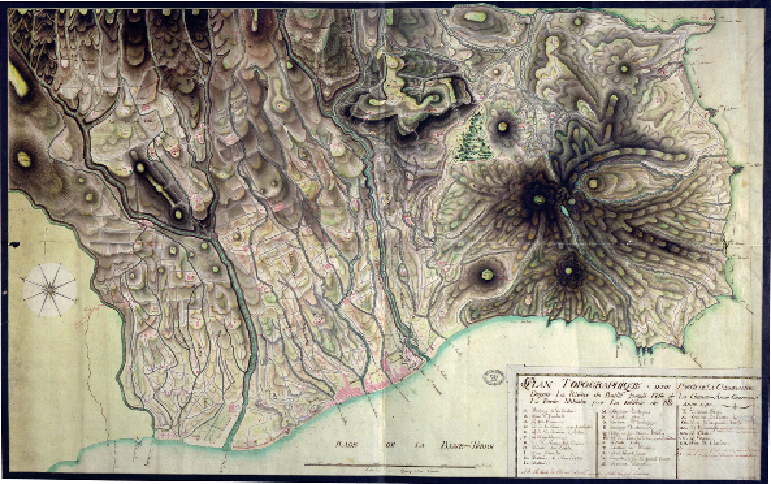
BASSE-TERRE, GUADELOUPE, 1793
By the end of the 18th century, Britain's military leaders were learning to value systematic
knowledge of any ground on which action might take place. Just as this was important at
home for defence of the English Channel coast, so it informed her overseas campaigns. At
the same time, her allies and enemies alike were becoming aware of the same lesson. The
French were cartographically advanced; they already had a printed national survey and their
military mapmakers were producing work of exceptional quality, especially with regard to
height depiction. These standards transported to their lands overseas.
Between 1793 and 1815 Britain and France were at war for most of the time. The conflict
in Europe was mirrored in their colonies, especially in the Caribbean where a number of is-
lands changed hands, some more than once. The archives thus holds maps such as this one
of islands usually considered part of the French empire. Guadeloupe had been colonised by
the French in 1635, and is still an overseas region of France today. This manuscript map was
made by the French in preparation for a British attack which came in April 1794, when the