Information Technology Reference
In-Depth Information
-
define the connection arcs and enter their quantified values;
-
run the simulation;
-
get the results.
The session would then explore the planning opportunities in a three-step process: updating
of project parameters, simulation run and result analysis.
It is clear that, while the simulation is performed by SPICE, all the tasks concerning the
initialisation and the update of scenario parameters and everything that deals with the
analysis of results are carried out by interacting with the user: it is precisely on these tasks
that author focused trying to provide planners with a system that would not hinder their
creativity, but rather that would foster it actively.
4.1 Effective viability graph input
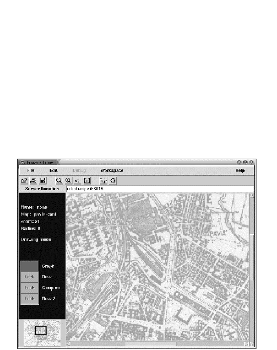
The first step a planner takes, unless retrieving a previously saved project, is to set a
cartographic map as the project graphic reference; all the other elements belonging the
scenario will be placed according to the project map, as showed in Figure 3. ULISSE lets
planners dimension the map by using a calibration command and then by defining a
segment of known length.
Fig. 3. Screen shot of ULISSE with the map of Pavia loaded
The next steps are the introduction of traffic junctions and branches (nodes and arcs of the
urban graph), as shown in Figure 4. Actually, author established that the arcs of the viability
graph could only be drawn by connecting existing nodes.
Search WWH ::

Custom Search