Information Technology Reference
In-Depth Information
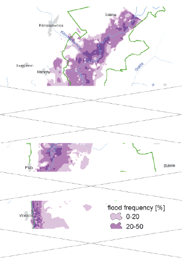
maps, used in the DSS system (Fig.9). This type of performance combined with the physical
and chemical studies of water are the basis for the analysis of biodiversity in wetland areas.
Fig. 9. Example of fluviogenic model results presenting of long-term annual mean flood
frequency on Biebrza Lower Basin in the vegetation season (February-September) in the
period 1961 till 1996 (Chormanski et al., 2009b)
9.3 Geostatic relationship of hydrology and ecology in riparian wetlands
The main purpose defined for the surface water flow model has been to generate suitable
hydrological data for the ecological module and the data for producing thematic maps with
the range of flooding for the DSS module. The long term flood characteristics are very
important for ecosystem development. Chormanski et al. (2011) described significant
relations between the distribution of plant communities and the extent of average floods,
which could be considered as long term average inundation conditions. One of the practical

Search WWH ::

Custom Search