Environmental Engineering Reference
In-Depth Information
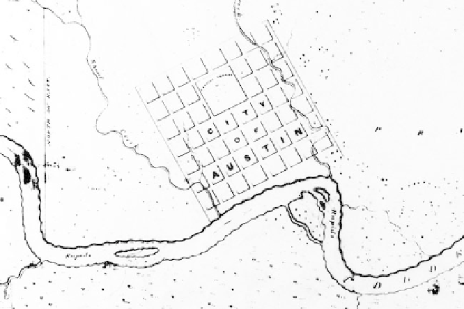
Figure 3.2
A detail of the 1839 Sandusky Map of Austin showing the original city limits bounded by
Shoal and Waller Creeks with Barton Creek in the bottom-left corner.
Source
:
Map L-2,
Austin History Center, Austin Public Library.
The focal point of environmental politics in Austin is not the two creeks
that defi ne the original east and west boundaries of the city or the Colo-
rado River but rather Barton Springs, a cluster of four freshwater springs
at the mouth of the Barton Creek watershed in the heart of the city. The
springs have been a noted locale for thousands of years; archeological and
historical evidence suggests that Native American settlements were sup-
planted in the nineteenth century by Anglo settlers who valued the site as
a public meeting place for recreation and community building. An 1884
newspaper article describes the springs as “Austin's Eden,” and this sacred
interpretation is echoed by a long-time swimmer who states that “Barton
Springs is like heaven, more a state of mind than a place.”
4
The municipal government acquired Barton Springs and fi fty acres of
surrounding land in 1917 from Andrew Zilker, one of Austin's founding
fathers, and built a dam below the springs to create a public recreational
pool. In 1931, Zilker sold an additional three hundred acres of adjacent
land to the municipality, stating that it was a “wrongful thing for this
beauty spot to be owned by any individual . . . it ought to belong to all
of the people of Austin.”
5
In the 1930s, the municipality used funds from
Search WWH ::

Custom Search