Geography Reference
In-Depth Information
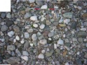
(a)
(b)
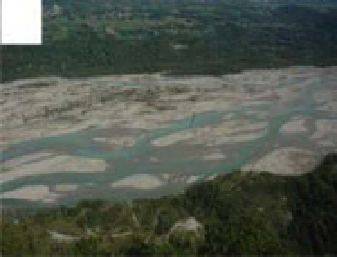
(c)
(d)
(e)
(f)
Figure 15.2
Contrasting examples of images acquired from ground technology: a) map of grain size across a river bar; b) river bank
morphology; c) channel planform; d) canopy cover and light-conditions within a riparian corridor; e) ice jam formation; f) wood jam
formation along an eroding bank.
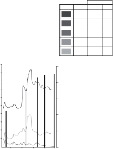
Wood surface
Date
21.04.99
(m2)
(%)
50
11100
10.05.99
17199
76
20.05.99
21188
94
26.05.99
22210
99
04.06.99
22487
100
1000
25000
900
800
20000
700
600
1500
Water
500
Dam
400
1000
300
200
5000
100
0
0
Evolution of the wood surface between
the 21.04.99 to the 04.06.99
27/4
7/5
17/5
27/5
4/6
Figure 15.3
A wood raft on the Genissiat dam, on the Rh one, France: An example of deposits and weekly survey of the reservoir's
wood coverage, between 21 April and 4 June 1999 (Modified from Moulin and Piegay, 2004).


Search WWH ::

Custom Search