Geography Reference
In-Depth Information
253200
253600
254000
253200
253600
254000
(a)
(b)
253200
253600
254000
253200
253600
254000
(c)
(d)
C) Elevation (m)
> 220
A) Legend
200
River bed
Edges old beds
Valley edge
Disturbed
D) Relative
elevation
High
Low
km
0
0.25
0.5
1
253200
253600
254000
(e)
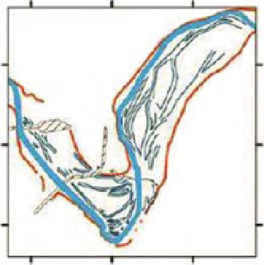
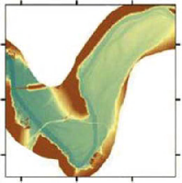
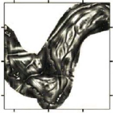
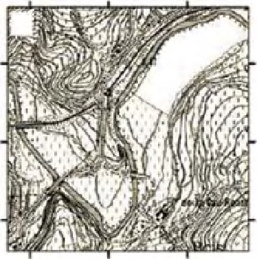
Figure 14.13
The
Ambleve Valley
near Cheneaux, Belgium. The geomorphological setting is shown (a). LiDAR depicts hillslopes (b)
and relative elevations (c). Fluvial features are also depicted (d), as compared to the paucity of information contained in a traditional
contour map (e). After Notebaert et al. (2009).


Search WWH ::

Custom Search