Geography Reference
In-Depth Information
Stage
recorder
Riffle 0
Bar 1
Pool 1
N
Riffle 1
Bar 2
Riffle 2
Pool 2
Pool 3
0 0 0 0
m
40
50
Riffle 3
Pool 4
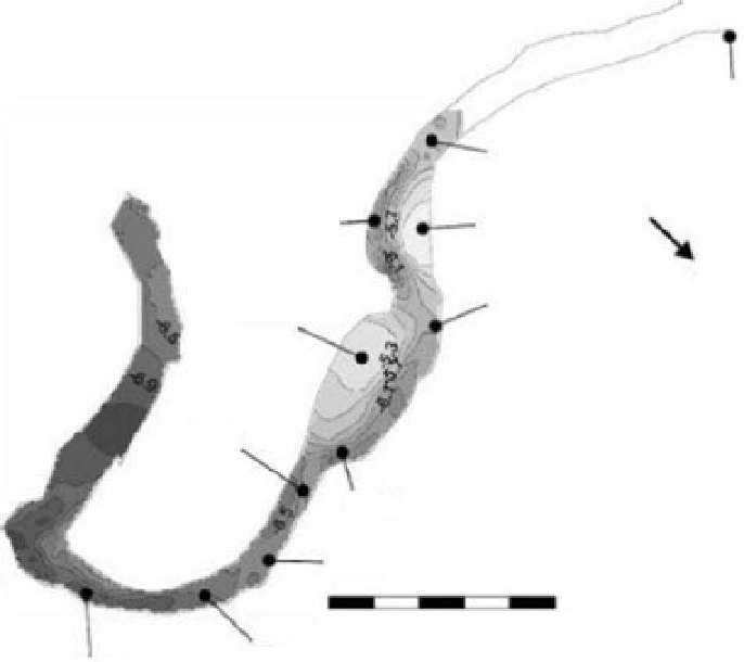
Figure 14.10
River Rede upstream of Catcleugh Reservoir, Northumberland, UK showing in-channel morphological unit
distribution in the reach subjected to ground-based laser scanning.
deeper pool areas, characterised by a slow flowing clear
smooth water surface, are clearly differentiated from
the rougher in-channel bar and riffle surfaces. As with the
South Tyne case study from Slaggyford (see above), the
Rede study demonstrated clear proof of concept for iden-
tification of within-channel, hydraulically-defined habitat
units using terrestrial laser scanning at the bar unit scale.
14.2.8 Terrestrial laser scanning
at the landscapescale
Moving beyond the reach scale, the scan range of
most contemporary ground-based scanners (generally
restricted to less than 500m to ensure a dense and precise
enough dataset) reduces their operational effectiveness
with multiple overlapping scans and increased post-
processing needed to cover larger areas. Nevertheless
some studies have attempted mapping extensive areas
using TLS in order to achieve greater detail and accuracy
over airborne laser data.
Hodgetts (2009) used the Riegl LMSZ420i terres-
trial
Figure 14.11
Detailed composite point cloud image generated
from meshing six different instrument scans of a 250m reach of
the River Rede, Northumberland, UK.
laser scanner to collect 85 linked georeferenced

Search WWH ::

Custom Search