Geography Reference
In-Depth Information
Habitat mapping
Flooding
Geomorph. changes
Riparian features
SSC & Water Chem.
2012
2012
2012
2012
2012
2010
2010
2010
2010
2010
2008
2008
2008
2008
2008
2006
2006
2006
2006
2006
2004
2004
2004
2004
2004
2002
2002
2002
2002
2002
2000
2000
2000
2000
2000
1998
1998
1998
1998
1998
1996
1996
1996
1996
1996
1994
1994
1994
1994
1994
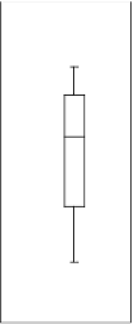
Figure 1.7
Distribution of the occurrence of the five most frequent topics (shown in Figure 1.6) within the set of 200 studied papers.
Box plots provide the two deciles and quartiles with a black line indicating the median and the red line showing the average.
that progress remains to be made in the applications of
FRS to the mapping and characterisation of stream biota.
Most of the papers dealing with flooding focused on
the use of the synthetic aperture radar (which can sense
through cloud cover) in order to map flooding extent
in near real time at both coarse and fine spatial resolu-
tions. This application uses both spaceborne platforms
(ERS-1, RADARSAT-1) and airborne platforms. Addi-
tionally, Landsat TM is used to determine inundation
from a range of flows because of its temporal capacity to
cover areas repeatedly. This topic area also makes heavy
use of topographical data derived from remotely sensed
sources in order to identify peaks, troughs and slopes
in flood affected areas. At large scales, the Shuttle Radar
Topography Mission (SRTM) DEM is commonly used.
At smaller scales, LiDAR is increasingly used to provide
high resolution, high accuracy topographic height and
even bathymetry (i.e. water depths). LiDAR also has the
advantage of measuring vegetation height, which can
be converted to friction coefficients. Generally speaking,
these flooding studies employ this range of FRS tools
in order to provide baseline data which is then fed into
hydraulic and/or hydrologic models.
In the geomorphic change topic, most of the contribu-
tions focused on channel changes at a decadal scale based
on repeated aerial photos or satellite imagery (e.g. SPOT
or Landsat) in order to understand bank or delta ero-
sion, meander migration rates and sediment production.
There is also a good volume of published work on the
spatial organisation of fluvial landforms or reaches and
the factors controlling them, notably geology, tectonics
and riparian vegetation which have often been conducted
over very long reaches (catchment and sometimes sub-
continental scales). Other papers also explored smaller
scale, in-channel morphological changes such as bars,
channel branches, considering their sizes, their forms
and the associated land cover attributes. At these smaller
scales, human pressures such as gravel mining and urban-
isation have also been discussed in the literature. In the
case of these smaller scale studies, air photo or satellite
imagery remains the norm. However, one contribution
used Synthetic aperture radar (SAR) imagery formonitor-
ing the changing forms of braided rivers over a short time
scale. This is likely a reflection of the technical progress in
SAR technology. Finally, fluvial geomorphology seems to
be the field where most methodological developments are
occurring. Here we find a significant body of published
works demonstrating the use of both passive and active
remote sensing in order to characterise channel width,
channel depth, riparian vegetation and sediment charac-
teristics. In terms of data sources, this area is dominated
by standard photography and LiDAR (both terrestrial
and airborne).
Abstracts found with the keywords 'Riparian Features'
were quite varied in content. However, in common
with the habitat mapping topic, vegetation identification


Search WWH ::

Custom Search