Geography Reference
In-Depth Information
Villette
convexity
Bridge
SNCF
Weir of
Pont d'Ain
1963
Bridge
of Priay
Bridge of
Chazey
Bridge
of Gévrieux
Weir of Neuville
sur Ain
80
Oussiat
convexity
60
Bellegarde
Martinaz
40
20
1980
80
60
40
20
Bridge of highway
A42
80
2000
60
40
20
5
10
15
20
25
30
35
Upstream
Downstream
Distance from Allement dam (km)
(a)
Bridge of St
Maurice de
Gourdan
40
Bridge of Priay
Martinaz
Weir of Oussiat
35
Bridge of
Chazey
Bridge of
Port Neuf
Weir of
Pont d'Ain
Bridge of
Gévrieux
30
Bridge
of SNCF
25
20
15
10
10
15
20
25
30
35
40
45
50
Upstream
Downstream
Distance from Allement dam (km)
(b)
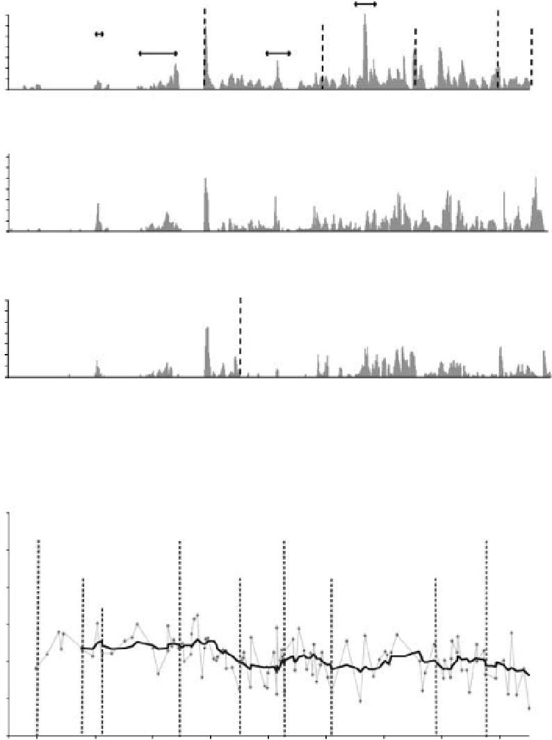
Figure 11.7
Analysis of the Ain river channel changes related to the Allement dam construction (1960) : aerial photos are combined
with field data (grain size data provided from ground imagery). a) Longitudinal distribution of gravel bars in 1963, 1980 and 2000
showing the progressive disappearance of the gravel surface from 10 m long segments, b) Longitudinal distribution of gravel bar grain
size showing the front of progressive erosion km 27 (dark line is a moving average, grey points are sampled bars).
Search WWH ::

Custom Search