Geography Reference
In-Depth Information
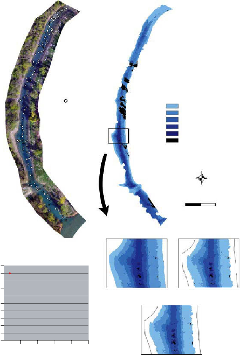
Depth of water predicted (cm)
Depth of water
observed
0 to
−
50
−
50 to
−
100
−
100 to
150
−
−
150 to
−
200
−
200 to
−
250
shadows
N
WE
S
50
Meters
0
25
(b)
(a)
Sedimentation
(cm/year)
50
45
40
35
30
25
20
15
10
5
0
y
=
43.204e
−
0.0009x
R
2
=
0.8886
2006
(Maximum depth
=
2.50 m)
+
10 years (2016)
(Maximum depth
=
1.99 m)
0
500
1000
1500
2000
2500
Days
(c)
+
20 years (2026)
(Maximum depth
=
1.98 m)
(d)
Figure 8.16
Characterisation of the 2006 bathymetry of the restored former channel of the Malourdie, on the upper Rh one, France
and simulation of its evolution : a) Image acquired from a UAV survey, b) Bathymetric map provided by the statistical relationships
linking observed depth and calculated depth from radiometric values, c) Prediction of temporal evolution of the sedimentation rate
model calibrated from field measures (red dots) d) Application of the model in (c) on the observed bathymetry (b) for the prediction
of bathymetric states in 2016, 2026 and 2036.


Search WWH ::

Custom Search