Geography Reference
In-Depth Information
in excess of 100 images with standard remote sensing
approaches, which usually function on a per-image basis,
is extremely labour intensive. Furthermore, crucial spatial
relationships which connect features in separate images
are easily lost or obfuscated due to the complexity of
the dataset. Therefore, enhanced data management is
generally required when dealing with hyperspatial image
datasets. The first option is to make better use of the image
metadata which is commonly available. Information such
as resolution (spatial and spectral), georeference, ground
footprint, can be encoded in the metadata and thus allow
for an increasing level of automation in terms of man-
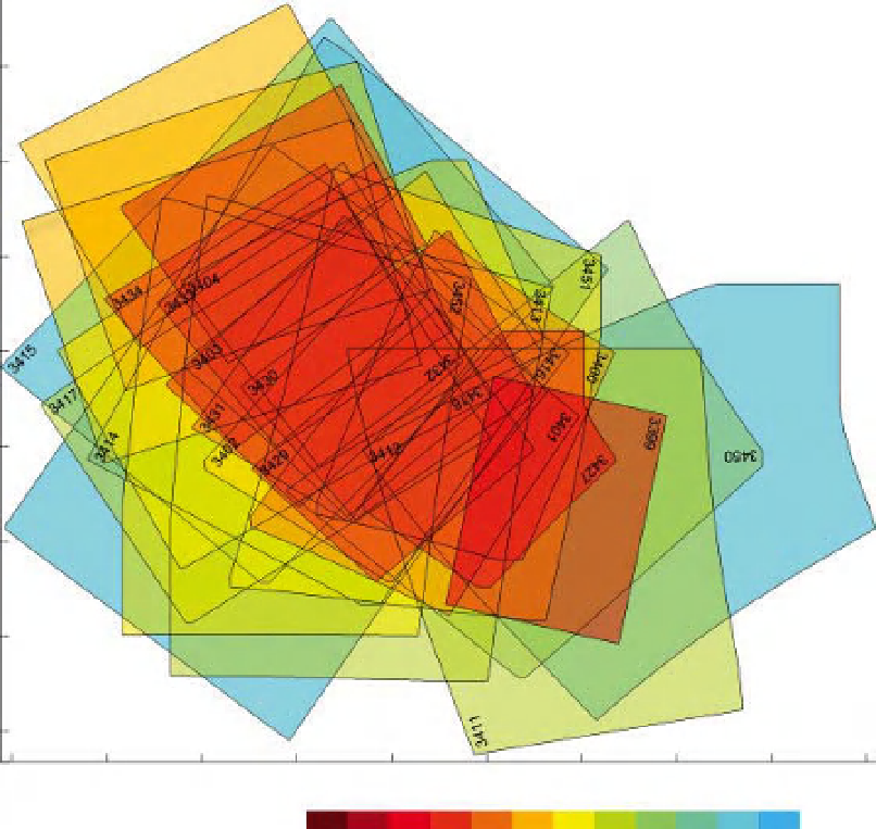
agement and analysis. For example, Figure 8.14 shows an
example of image footprints plotted spatially along with
the spatial resolution which is plotted in a colour scale.
In this case we are dealing with a small number of images
and the added metadata is easily managed. However, in
the case of the large image databases discussed above, the
enhanced use of metadata is insufficient since standard
GIS packages are simply not designed to deal with such
large databases.
A few researchers are therefore modifying or creat-
ing GIS software that is suited to the study of fluvial
environments with remotely sensed data. For example,
Thorp et al. (2010) discuss an integrated GIS approach
which uses multiple data sources in order to characterise
the hydrogeomorphology of an entire catchment and
quantify the success and viability of rehabilitation efforts.
McKean et al. (2009) use a freely available toolkit for
Arc GIS called the River Bathymetry toolkit. This toolkit
×
10
5
2.649
2.6485
2.648
2.6475
2.647
2.6465
2.646
2.6455
8.4505
8.451
8.4515
8.452
8.4525
8.453
8.4535
8.454
8.4545
8.455
Longitude (m)
×
10
5
0.04
0.05
0.06
0.07
0.08
0.09
0.1
0.11
0.12
0.13
0.14
0.15
0.16
Image resolution (m)
Figure 8.14
Example of advanced image management. Image boundaries overlays for a large set of photos acquired during a single
campaign along the Dr ome River, in 2005.
Search WWH ::

Custom Search