Environmental Engineering Reference
In-Depth Information
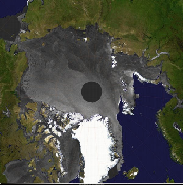
Fig. 9.11
Envisat ASAR and visible (MERIS) composite mosaic from 14 January 2006 (Courtesy
of Microsoft Vexcel UK, ESA PolarView Consortium)
since provided routine polar Ku-band observations since 1999. MetOp-A, the first
in a series of three satellites, ensures continuity in the C-band time series of
advanced scatterometer (ASCAT) measurements for the next 15 years.
While ice extent is the most commonly examined sea ice variable, the most
important is ice thickness. In situ, ship, submarine, and EM observations of thickness
are limited spatially and temporally. Unfortunately, thickness is the most difficult ice
property to estimate from space. The NASA ICESat satellite has a laser altimeter,
though it recently failed, that can provide estimates of sea ice surface elevation. Laser
altimeters are subject to cloud contamination, limiting the geographic coverage of
useful surface data. Altimeters do not measure ice thickness directly, but rather they
measure the elevation at the top of the surface, including the overlying snow cover.
Accurate estimates of sea ice thickness therefore require some assumptions about
snow depth and the relationship between ice draft (the part of the ice below the water
level) to ice thickness. ICESat was designed primarily for ice sheet and glacier
detection, not sea ice, and was originally to have flown in parallel with CryoSat,
whose radar altimeter was optimized for sea ice. Unfortunately, CryoSat never
Search WWH ::

Custom Search