Image Processing Reference
In-Depth Information
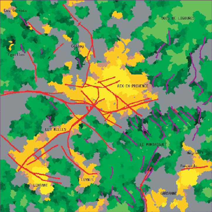
Figure 9.4.
Result obtained from the image in Figure 9.2 by fusing detectors of different
structures. The lighter areas represent urban areas. The dark lines correspond to roads,
the lighter lines to slopes. The darkest areas (with different shades) are forest areas.
Finally, the medium gray areas correspond to the empty set, i.e. unrecognized areas
of elements of anatomical knowledge. The localization and morphology information
of this object are provided by the atlas and symbolic information about this object is
expressed with respect to objects identified in the previous steps. This symbolic infor-
mation concerns spatial relations (pertaining to sets, directions or distances) as well
as constitution information (gray matter, white matter or liquid) or radiometric knowl-
edge related to the type of imagery. The fuzzy set framework was chosen for several
reasons: it allows us, using a single formalism, to express elements of information with
different semantics, of which there can be many for this problem. It also allows us to
model the imprecision and the uncertainty, which is particularly important in this field
Search WWH ::

Custom Search