Environmental Engineering Reference
In-Depth Information
46% of the territory of the country are being eroded. Parts of the territory of China are overlaid with
loess; these include the southern part of the northeastern China and the southeast part of the northwestern
China. The loess widely spreads over the Yellow River basin extending from the east of Qinghai Province
in the west and the relics of the Great Wall in the north to Qinling Mountain in the south and the coastal
region in the east. The loess is quite uniform in its textural lack of granular structure, and it is bound
together mainly by calcium sulphate that is highly soluble and apt to be leached and eroded by rainfall. In
addition, with a porosity ratio as high as 40%, loess is characterized by well-developed vertical joints
that are susceptible to erosion and weathering. Over history, most of the vegetation in the basin has been
destroyed and the erosion process has been aggravated. The severe soil erosion has not been brought
entirely under control over the basin, although great efforts have been devoted to soil conservation. According
to preliminary statistics, annual soil loss in the middle Yellow River basin amounts to 3,700 t/yr.km
2
, on
average, which is about 27.5 times the average annual rate throughout the world of 134 t/yr.km
2
. Enormous
amounts of sediment are eroded from the basin and flow through mountain creeks and streams to the river,
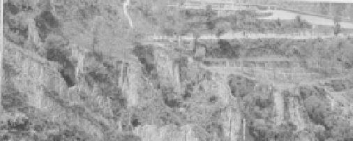
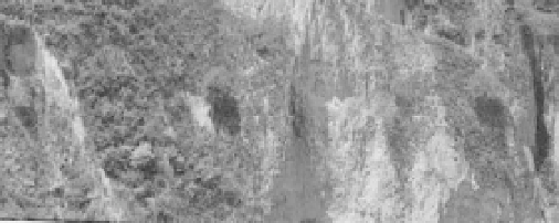
producing a sediment concentration that is higher than in almost any other part of the world. Figure 1.29
shows the Loess Plateau consisting of very erodible soil.
Fig. 1.29
Soil erosion in the Loess Plateau of central China bring a huge amount of sediment to the lower reaches
of the Yellow River (See color figure at the end of this topic)
The total soil volume eroded from the Yellow River basin is about 2.3 billion tons per year. Comparably,
the total soil volume eroded from the Yangtze River basin is about 2.2 billion tons per year. From 1950 to
1996, the Chinese people had improved 0.7 million km
2
of the land susceptible to water-erosion, but in
the mean time, the total land susceptible to water-erosion has increased from 1.16 million km
2
to 1.82
million km
2
. As a result the untreated land susceptible to water-erosion remains at 1.13 million km
2
(Wang,
2000). The main causes for the increase of land susceptible to water-erosion are deforestation, overgrazing,
harvest of medical herbs, slope tillage, development of mining and urbanization. For instance, people in the
Xiaojiang watershed on the Yunnan-Guizhou Plateau of China cut trees and burned the wood for iron and
copper production in 1958. The forest cover was reduced from 23% to 18% due to logging and the erosion
rate was almost doubled. In the Yangtze River basin alone, the area of steep slope land people are still
plowing is more than 11 million ha. The Shenfu-Dongsheng coal mining removed 162 million tons of
soil in the period 1998-2000, and thus, greatly intensified the erosion rate.
Erosion causes many problems. More than 5 billion tons of fertile soil are lost every year due to erosion,

Search WWH ::

Custom Search