Environmental Engineering Reference
In-Depth Information
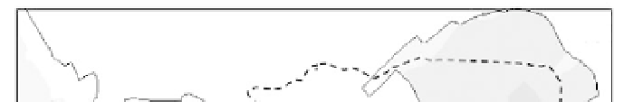
Fig. 8.17
Bathymetry of Hong Kong waters: the inset figure is the predicted water level during March to April 1998 at
station ELM1 in East Lamma Channel
8.3.1
Tidal Currents
The water circulation in an estuary is mainly dominated by tidal exchange with the adjacent open sea.
Astronomical tides, or simply tides—the regular rise and fall of the sea surface—are due to the relative
motion of the earth-moon-sun system. In most regions, tides are semi-diurnal, meaning that during a typical
day there are two high tides and two low tides. Depending on the location (latitude and topography), and
time of the year, tides may be diurnal, meaning that there is only a single high tide and a single low tide
in a day. A rising tide is termed a flood tide and a falling tide is termed an ebb tide. The moment when
the water reaches its highest point at high tide (or its lowest point at low tide) is called the slack tide. The
tidal range, defined as the difference in height between a high water and the following low water, also
varies periodically with the phase of the moon in a given month. Tides of maximum range, known as
spring tides, occur twice in 29 days, when the lunar and solar tide generating forces reinforce each other
at around full and new moon. Likewise, tides of minimum range, known as neap tides, occur when the
lunar constituent is opposed by the solar constituent—around the first and third quarter of the moon.
An accurate prediction of tides can aid the interpretation of water quality data and the planning of field
surveys. In particular, it has been found that tide level is an important predictor for a few water quality
parameters. Tidal prediction at a given location can be based on an extended harmonic analysis of a long
term record (typically one year of hourly observations), in which tides are represented as the sum of a
number of constituents of exactly known frequencies (derived from equilibrium tide theory, see e.g., Bowden,
1983). The harmonic analysis gives the standard amplitudes and phases of the tidal constituents—which
can be used for prediction of tidal levels for that location. For example, Fig. 8.18 shows the comparison
between predicted and observed tidal heights (based on 25 key tidal constituents) for typical tidal cycles
in dry season. It is found that the tide level is well-predicted—in general with an average error of 0.1-0.2
m. Also shown are predictions based on tidal constituents derived from a calibrated three-dimensional
(3D) hydrodynamic model (9 tidal constituents); with fewer harmonics the 3D model prediction is not as
good, but still the phase is well-reproduced.


Search WWH ::

Custom Search