Environmental Engineering Reference
In-Depth Information
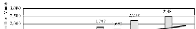
Fig. 1.24
Flood losses in 1991-1999 compared with the average annual loss in the 1980s (after Cheng, 2002)
Songhua
River
0
0 600 1,200 km
600
1200 km
1
Beijing
Haihe
River
Shanghai
River
Fig. 1.25
Major rivers and high flooding risk areas (shaded areas) in China
industrialized, therefore, the potential flood damage costs are high. The climate of China is mainly monsoon
type and rainstorm floods occur in the summer. The precipitation concentrates within a few months and
results in well defined flood and low flow seasons. For instance, the flood season is from late June to
September for the Yangtze River, from July to August for the Yellow River, from the mid of July to August
for the Haihe River and from August to September for the Songhua and Nenjiang Rivers. The rainfall
intensity in China is high, therefore, the peak discharge is high. Figure 1.26 shows the highest flood discharge
of various scales of the drainage areas in China compared with those of the world highest values. The
recorded peak discharges are nearly equal to the highest in the world. With the high peak discharge and short
flood season, the floods of Chinese rivers are difficult to predict and control (Luo and Luo, 1996).
The 2005 flood on the West River, the 1998 floods on the Yangtze and Songhua Rivers, and the 1996
floods on the Yellow and Haihe Rivers indicate a trend of increasing flood disasters. Figure 1.27 shows
that a 100-year flood that hit Wuzhou on the West River basin in Southern China in 2005. Flood water flowed
over the levee and flooded the residences and the commercial areas of the city. The flood loss was great.


Search WWH ::

Custom Search