Environmental Engineering Reference
In-Depth Information
counties with a total flooded area of 8,637 km
2
and killed 18,293 people.
1938
—On June 9, 1938 the embankment at Huayuankou was broken by the Chinese army attempting
to stop invasion by the Japanese army. The river emptied itself through an inundated land area of about
50,000 km
2
, and finally captured the Huaihe River channel. Consequently, the river shifted its major
course from north to south and flowed into the Yellow Sea for 8 years, as shown in Fig. 6.5. More than
890,000 people were killed and 3.9 million people lost their homes and farmland. The river flowed on
the plain without any fixed channel and levees and in the Huaihe River channel for 8 years. It brought
about 10 billion tons of sediment deposition and created the Huangfan flooded area of 54,000 km
2
, which
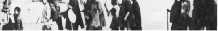
is desert-like land with low productivity and poor vegetation. Figure 6.6 shows that people were escaping
from their flooded homeland in 1938.
1958
—A heavy rainstorm occurred in the drainage area between Sanmenxia and Huayuankou with 5
days of rainfall totaling 198 mm. The crest discharge at Huayuankou was recorded at 22,300 m
3
/s and the
Fig. 6.5
Extent of the man-made flood caused by exploding the levee at Huayuankou in 1938. The flood water flowed
on the plain and finally flowed into the Huaihe River, which created the 54,000 km
2
Huangfan desert
Fig. 6.6
About 890,000 people were killed and 3.9 million people lost their homes and farmland. This figure shows
people escaping from their flooded homeland (after YRCC, 2001)


Search WWH ::

Custom Search