Geology Reference
In-Depth Information
[m]
25
(A)
26°
25°
Cryoplanation
terraces
0°
20
Tors
27°
0°
19°
Cryoplanation
terrace
15
25°
11°
27°
10
[m]
8
5
5
0
0
0
10
20
30
40
50
Metres
Blockfield
Frost-riven cliff and bedock outcrops
(B)
Upper
slope
Pediment
junction
Covered
pediment
Bare
pediment
24°
150
Sandstone
bedrock
9°
8°
7°
6°
5°
40°
Shale bedrock
0
450
900
Metres
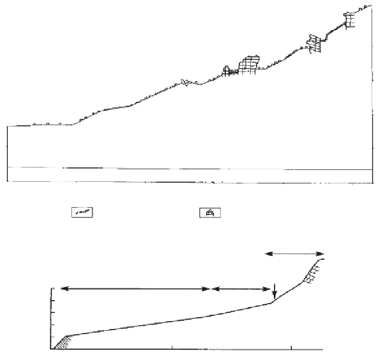
Figure 9.5.
Irregular and straight debris-mantled slopes. (A) Slope profi le showing “frostcliffs”
(tors) and cryoplanation terraces developed upon dolomite of Cambrian age, Aldan River, Central
Yakutia, Russia. From Czudek (1990). (B) Topographic profi le of a pediment in the Barn Moun-
tains, unglaciated Northern Yukon Territory, Canada. Reproduced with permission from French
and Harry, 1992, Blackwell Publishing.
northern Yukon Territory, and central Alaska (Czudek and Demek, 1973; Demek, 1972a;
French and Harry, 1992; Hughes, 1972b; Nelson, 1989; Priesnitz, 1981, 1988; Priesnitz and
Schunke, 1983). In the periglacial literature, the surfaces are sometimes termed cryopedi-
ments, “gently-inclined erosion surfaces developed at the foot of valley sides or marginal
slopes of geomorphological units developed by cryogenic processes in periglacial condi-
tions” (Czudek and Demek, 1970, p. 101).
Cryopediments vary in angle from as much as 8-10° in their upper sections to as low
as 1° in their lower sections (Figure 9.5B). Usually, only a thin veneer of surfi cial material
mantles the slope (see Figure 2.6B). J. Dylik (1957) was one of the fi rst to conclude that
these forms are analogous to the pediments of tropical and sub-tropical regions.
Pediments in hot arid regions have been the subject of considerable controversy in the
geologic and geomorphic literature; they are generally believed to be rock-cut transporta-