Travel Reference
In-Depth Information
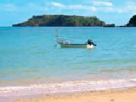
Abuōrujima, one of several uninhabited islets at Oura Bay.
3
NAGASHIMA
長島
Directly west across the mouth of Oura Bay, 3 miles (5 kilometers) over water but 10.5
miles (17 kilometers) by road around the bay is Oura Bay's opposite, southern promontory,
Cape Henoko (
辺野古崎
; Henokozaki). At the end of Cape Heneko are two more islets, Na-
gashima (
長島
; Naga-shima) and Tairajima. Both are about 2,300 feet (700 meters) offshore.
Naga means “long” and that's a good way to describe this one as it's actually a 1,400-feet
(425-meter)-long string of three mini-islets and a few connected rocks. Most of it is only
around 100 feet (30 meters) wide, but at its widest it's 330 feet (100 meters). On the largest of
the three islets there's a little beach and then a 330-foot (100-meter) path leading to the isle's
highest point, on its eastern end, where there is a light beacon.
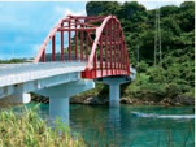
A colorful bridge above pristine waters connects Miyagijima and Ikeijima.
4
TAIRAJIMA
平島
About 1,150 feet (350 meters) south of Nagashima (“Long” Island) is Tairajima (
平島
; Taira-
jima; “Flat” Island). There's not really too much to say about this one either. It's more or less
round and about 490 feet (150 meters) in diameter. Incidentally, both of these islets are just
of Cape Henoko, which is controlled by the US Marines. It's part of Camp Schwab, formerly
called Camp Henoko, and still the home of the Henoko Ordnance Depot, an ammunitions
storage facility on base. Unless you've got military ID, it's a restricted area.