Travel Reference
In-Depth Information
Ōkuni-rindo Forest Road
How about taking a roller coaster-like ride through the Yanbaru jungle? Someimes said to be the best
kept secret in Okinawa, a drive on the Ōkunirindo (lit. “big country forest road”) takes you through
some of the most rugged mountains and deepest jungle forest on the island from the comfort of your
air-condiioned car. But it's not for those with squeamish stomachs or kids with moion sickness. It's
an up and down, twising, zigzag mountain road running the whole length through the center of the
top of Okinawa. It's perfect for those who would like to experience the nature and beauty of the Yan-
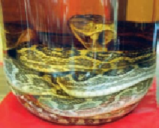
baru Forest but might not appreciate the heat, humidity, insects or
habu
snakes of a mountain hiking
expediion. Ōkunirindo's southern end is at Route 331, near Ōgimi village (
大宜味村
; Ōgimi-son). Al-
though it's possible to drive on a number of jeep tracks all the way to Oku (
奥
), the northernmost
village on Okinawa, most people will be content with the 22 miles (35 kilometers) from 331 to Route
2, just above Mt Yonaha, in Kunigami (
国頭村
; Kunigami-son). The road provides the nearest access to
the hiking trail for Yonaha. If you find the going too rough, there are places to bail out and either head
east to Route 70 or west to 58. One of the side roads goes past Hiji Falls, taking you back to Okuma.
Route 2 is Okinawa's northernmost road connecting the west coast (Route 58) and east
coast (Route 70). Route 2 is 7.5 miles (12 kilometers) long from the junction with Route
58 to the intersection with Route 70. Midway across, at almost exactly 4 miles (6 kilomet-


