Travel Reference
In-Depth Information
The new western bridge connecting the Motobu Peninsula to Yagajijima.
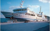
The ferry to Iheyajima berthed at Unten Port.
Let's express the distance around the Motobu Peninsula more succinctly. If we start in
Nago, take the southern coastal loop road west to Motobu Town, then continue north to
the Churaumi Aquarium, then return east via the northern coastal loop road to Nakijin,
then continue to the junction of Route 58 and take it south to Nago—a nice big clockwise
circle—it's a total of 31 miles (50 kilometers). Add about 4.5 miles (7 kilometers) for the
round trip from Nakijin to Unten Port if you wish to go there. Thirty miles (48 kilometers) is
not a great distance, yet driving on Okinawa is rarely comparable to a cruise down a US In-
terstate Highway. Figure on at least 3-4 hours to make the circuit. And, of course, that's only
a circuit. If you wish to explore the mountain roads in the interior of the peninsula, you can
easily spend a day. There are good views and, perhaps surprisingly, good cafés in the most
remote places on the Motobu, so don't be worried about delving into this little explored part
of the island.
9
CAPE AKAMARU
赤丸岬
From the Route 505/58 intersection it's just a little over 25 miles (40 kilometers) north to
Cape Hedo. From Nago it's 30 miles (48 kilometers). It is a lovely drive all the way up the west
coast as the road hugs the shoreline almost the entire distance. A little more than halfway,
14 miles (22 kilometers) from the intersection, you'll come to the village of Okuma (
奧間
;
Okuma), and 1 mile (1.5 kilometers) to its west a small promontory capped with a bulbous