Geoscience Reference
In-Depth Information
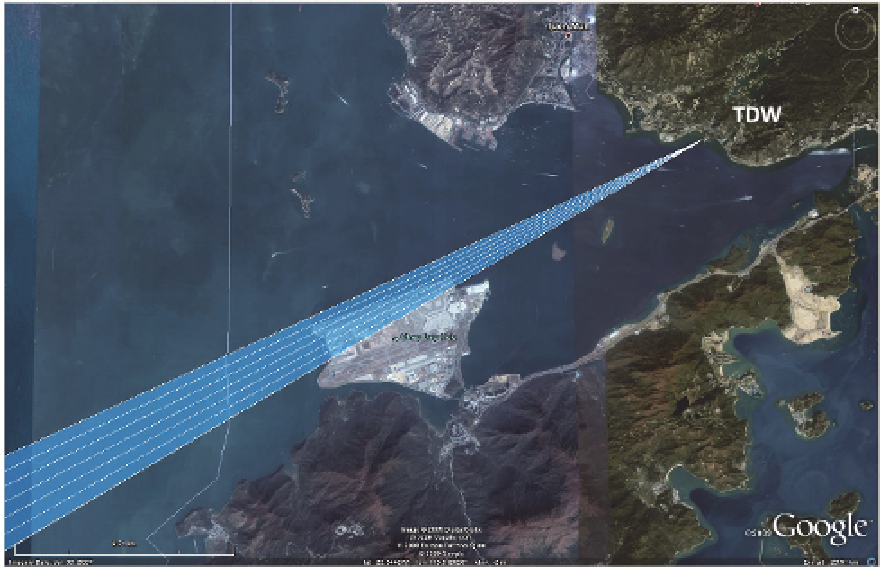
Fig. 1. The locations of the Hong Kong TDWR (red dot) radar and Hong Kong International
Airport (HKIA). The blue beams illustrate the radar beams over the runways corridor 07LA
of the airport with 1
o
azimuth interval. Three yellow lines indicate the approach paths and
their names are marked.
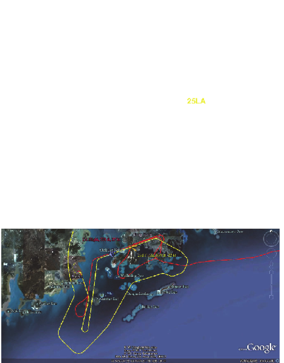
Fig. 2. Flight paths of the two aircraft which had to conduct missed approach. Red line
indicated the flight path for the first aircraft and yellow for the second aircraft. Orange
wind barbs showed the locations of aircraft when tailwind was encountered. The 1
st
and 2
nd
aircraft recorded tailwind of 37 and 22 knots respectively.