Geoscience Reference
In-Depth Information
6.4 WDSS-I and II - USA
WDSS-I was a research analysis tool and made great strides in developing innovative
algorithms and concepts. WDSS-I (Eilts et al, 1996) processed single radar data. A
particular innovation was the Storm Cell Identification and Tracking algorithm (Johnson
et al, 1998) which ranked the storms by severity. This extended the SWP product from
RADAP-II. This system is commercially available from Weather Decision Technologies.
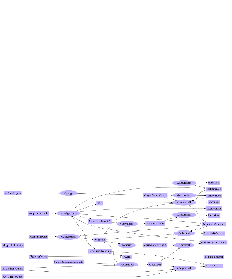
WDSS-II was an enhanced version of WDSS-I (Lakshmanan et al, 2006). It has a multi-
radar capability and integrates other data. Fig. 7 shows a chart of the data processing flow
and lists the algorithms. A technical innovation is in the handling of radar data in overlap
regions. Radar cell identifications (and others such as mesocyclone detection) are first
done along each PPI surface to identify 2D cell objects. Then these 2D objects are collated
together into a 3D multi-radar object. A five minute window is used to aggregate the data
and cells are time shifted to a common moment in time. A service innovation is that this
extends the warning service capability to a regional level (more than the domain of single
radar). WDSS-II saw the return to the display of more imagery to support experts in their
decision-making (Fig. 8).
Fig. 8 shows shear fields and aggregated shear fields. While they were computed as part of
the severe weather algorithms internal computations, they were not previously displayed.
With the development of fast computers and display capabilities and the realization that
expert forecasters can effectively use these products, they became in vogue.
Fig. 7. The data flow of the WDSS-II system. This system integrates “other” data (numerical
weather prediction data) including model data into the radar processing. While this is
common for QPE applications to help identify the bright band or melting level, this was an
innovation in severe weather processing.