Geoscience Reference
In-Depth Information
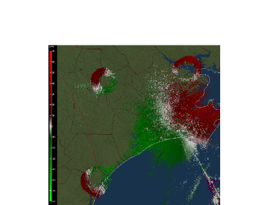
leaving roost early in the morning. The critters are diverging away from the roost in search
of food. Close to the radar the continuous field of velocities is principally from reflections off
insects filling a good part of the boundary layer (this is deduced from polarimetric
signatures, but not shown here).
Fig. 19. Field of velocities obtained from the radar at Moorhead City, NC, on July 27, 2011 at
5:08 in the morning. The color bar indicates categories in kts; red away from the radar and
green is toward. Elevation is 0.5
o
.
6. Epilogue
The WSR-88D network has been indispensable for issuing warnings of precipitation and
wind related hazards in the USA. And its real time display of storm locations has become
one of most popular and common applications on cellular phones. Its role in quantitative
precipitation estimation is matching that of rain gages. So, what is beyond these
achievements for the WSR-88D? Dual polarization upgrade combined with Doppler
capability is the panacea a radar with the dish antenna on a rotating pedestal can achieve.
Promising possibilities are: polarimetric confirmation of tornado touchdown at places where
Doppler velocities indicate rotation; improvement of ground clutter filtering; polarimetric
spectral analysis for extracting/separating features within radar resolution volume;
significant improvement in data interpretation; inclusion of wind and precipitation
type/amount in numerical prediction models; and other. Clearly the evolutionary trend
continues and will do so at a decelerating pace until a plateau is reached. Complementary
shorter wavelength (3 cm and 5 cm) surveillance radars are being considered for closing
gaps or providing extra coverage at opportune places. (The TDWRs 5 cm wavelength radar
data has been supplied to the NWS for several years). Explored are networks of tightly
coordinated 3 cm wavelength radars for surveillance close to the ground.

