Geoscience Reference
In-Depth Information
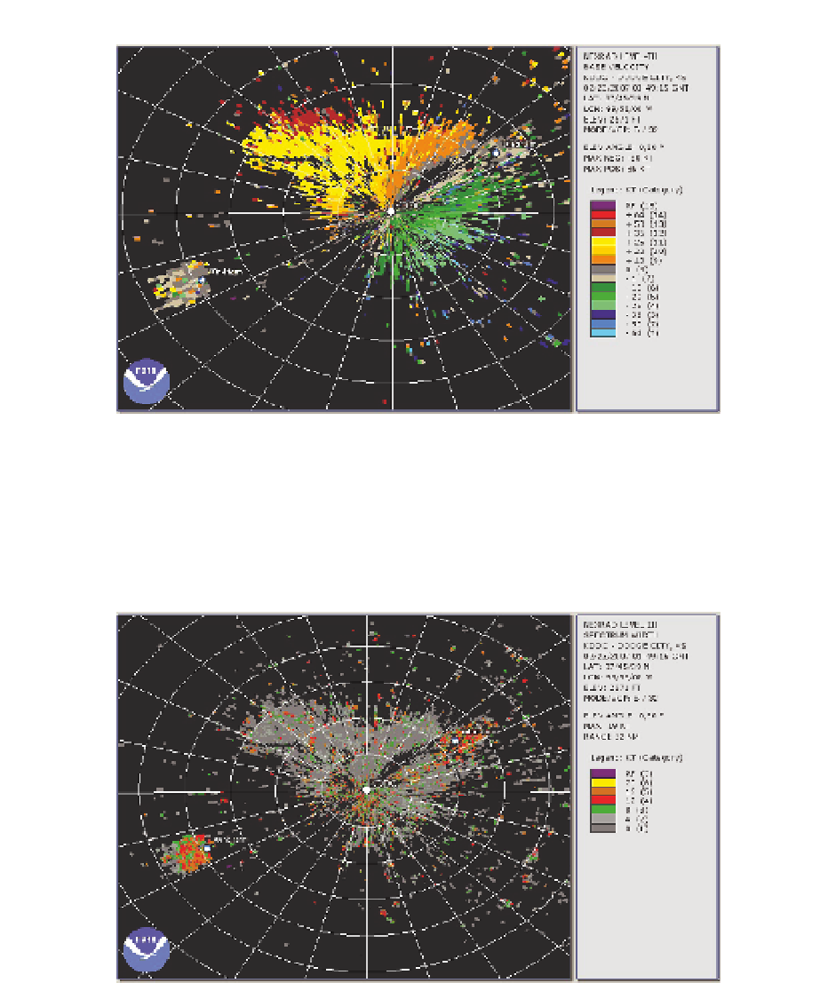
Fig. 10. Wind measurements from the weather radar near Dodge City, Kansas, at 0149 GMT,
on February 23, 2007. The general wind direction is to the northwest but measurements near
a wind farm to the southwest of the radar show wind velocities close to zero. Range rings in
white are at 10-km spacing. Adapted from Vogt et al. (2007a). This image was obtained from
NOAA/National Climatic Data Center.
Fig. 11. Measurements of spectrum width from the weather radar near Dodge City, Kansas,
at 0149 GMT, on February 23, 2007,. The spectrum widths are considerably enhanced near a
wind farm to the southwest of the radar. Range rings in white are at 10-km spacing. Adapted
from Vogt et al. (2007a). This image was obtained from NOAA/National Climatic Data
Center.