Geoscience Reference
In-Depth Information
cloudy, and most importantly, rainy conditions. Some correction procedures to remove non-
precipitating echoes rely only on radar data (e.g. Berenguer et al. 2006, Sánchez-Diezma et
al. 2001, Steiner & Smith, 2002) but others consider as well the use of satellite observations -
see for example Michelson and Sunhede (2004), Bøvith et al. (2006) or Magaldi et al. (2009).
In any case, quantitative applications of radar data such as thunderstorm tracking (Rigo et
al., 2010), precipitation estimates (Trapero et al. 2009), or radar-based precipitation forecasts
(Atencia et al., 2010), or even qualitative use of radar images by a non-specialized audience
(as discussed in Bech et al. 2010b), clearly require the use of proper clutter filtering,
particularly considering anomalous propagation.
6.1 Methodology
We summarize in this section the methodology proposed by Magaldi et al. (2009) to detect
and remove AP echoes in radar images using satellite observations and NWP model data.
They took advantage of the improved temporal and spatial resolution of the Meteosat
Second Generation (MSG) satellite to update the procedure developed by Michelson and
Sunhede (2004), based on the first generation of Meteosat satellites, and incorporated the use
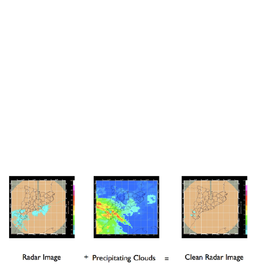
of enhanced precipitating cloud masks. Fig. 17 illustrates the basic idea behind the proposed
methodology, showing a radar reflectivity image with real precipitation and clutter (in this
case sea clutter, near the coast), the precipitating cloud mask associated, and the new image
where clutter has been removed.
Fig. 17. Illustration of the correction procedure of radar reflectivity echoes affected by clutter
(left panel) with a precipitating cloud mask (centre panel) and the resulting cleaned radar
image (Vallirana radar, 1 January 2004 14 UTC).
The basic algorithm is shown on Fig. 18, where a data flow diagram showing the different
processes involved is displayed. Analysis of radio propagation conditions with radiosonde
(RAOB) data (vertical refractivity gradients below -80 km
-1
or ducting index above 20) was
used to select AP events. For those events, MSG satellite and NWP MASS model data were
used to build precipitating cloud masks based on the SAF (SAF 2004, 2007; hereafter S) and
Michelson and Sunhede (2004) algorithms (hereafter M). These masks were compared pixel
by pixel with radar data, and non-precipitating pixels were removed in the final corrected
radar data.