Geoscience Reference
In-Depth Information
overlaid powers of first and second trip signals are within 10 dB and hence velocities can not
be confidently recovered. There is a narrow pink ring of censored data in the image where
phase code is applied. The beginning range of the ring is at the start of the second trip (175
km) and is caused by automatic receiver shut down during transmission followed by the
strong first trip ground clutter overwhelming the weaker second trip signal.
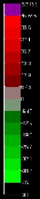
Fig. 7. Fields of Doppler velocities. Left: obtained from phased coded sequence. Right:
obtained from non coded sequences. Elevation is 0.5
o
, the unambiguous velocity
v
a
= 23.7 m
s
-1
and range
r
a
= 175 km. Data were collected on 10/08/2002 with the research WSR-88D
(KOUN). The color bar indicates velocities in m s
-1
. (Figure from Torres et al., 2004c).
3.3 Ground clutter filter
The ground clutter filter implemented on the network is a frequency domain filter with
interpolation over the removed clutter spectral coefficients. The filter called Gaussian Model
Adaptive Processing (GMAP) has been developed by Siggia and Passarelli (2004). Its first
premise is: clutter has a Gaussian shape power spectrum with width linearly related to the
antenna rotation rate; hence the width can be computed. The second is the signal spectrum
has also Gaussian shape and has width larger than clutter's. The Blackman window is
applied followed by Fourier transform. Receiver noise is externally provided to the filter
and used to establish the spectral noise level which helps determine how many spectral
coefficients either side of zero to remove (Fig. 8, blue peak is from ground clutter). The
removed coefficients are replaced (iteratively) with a Gaussian curve obtained from Doppler
moments and the spectrum of the weather signal (dotted curve) is restored. Then the inverse
discrete Fourier transform is performed to obtain the autocorrelation at lag 1. The argument
of the autocorrelation is linearly related to the mean Doppler velocity (see section 3.4).
Several options exist to decide where to filter clutter. One relies on the clutter map to locate
azimuths and ranges. It is also possible but undesirable to apply clutter filter everywhere.
The operators can select regions between azimuths and ranges where to turn the filter on.
Recently an adaptive algorithm called Clutter Mitigation Decision has been implemented
(Hubbert et al., 2009). It uses coherency of the clutter signal exemplified in what the authors