Geoscience Reference
In-Depth Information
3.2 The extreme spatio-temporal variability of the precipitation field in semi-arid
regions
In this section, a typical Mediterranean thunderstorm hitting the Palermo town in Sicily is
presented. More details are given in the caption of Fig. 4 below, while QPE performances of
the Palermo mini radar are thoroughly discussed in Sec. 4.2.1 and 4.2.2.
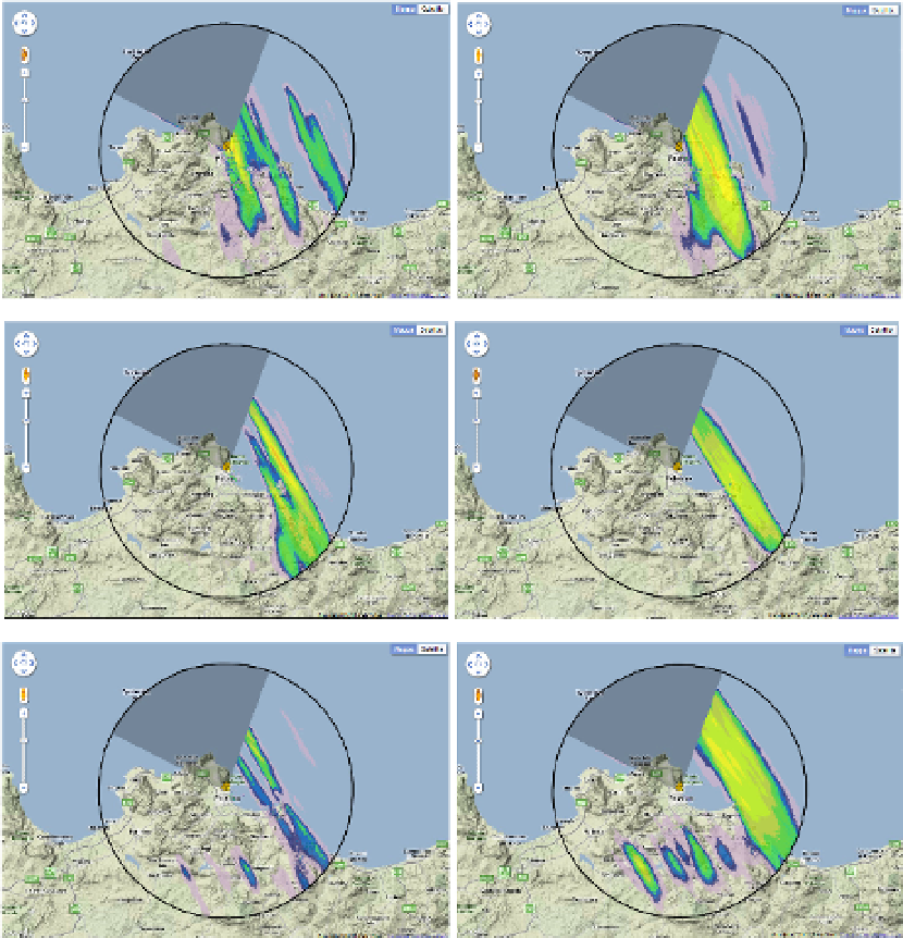
Fig. 4. Average hourly precipitation field on the evening of February 18, 2011 in the northern
part of a dry Mediterranean island (Sicily); it is worth noting the “wide precipitation band”
shape and the high spatial variability of the field despite the averaging process used to
derive hourly cumulated rainfall amounts. Each of the 6 consecutive pictures shows the
average of 60 instantaneous maps of radar reflectivity (one per minute) transformed into
equivalent rain rate using a fixed Z-R relationship. The first picture shows hourly
accumulation rainfall amounts from 16 to 17 UTC; the last one from 21 to 22 UTC. The
circular range ring is at 30 km range from the site of the mini-radar.