Geoscience Reference
In-Depth Information
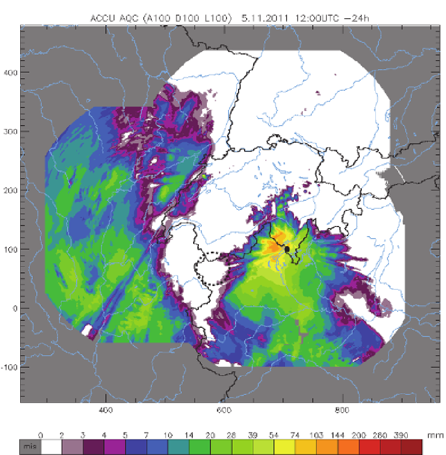
Fig. 3a. 24-hour cumulative rainfall amounts in the western Alps as seen by the Swiss
weather radar network (from 12 UTC of November 4 to 12 UTC of November 5, 2011).
North and East axes map units are in km.
What if we supplement long-range weather radar information with precipitation fields
derived at high spatio-temporal resolution by portable, low-cost X-band radars? The
answer is given in Fig. 3b, which shows what the low-cost X-band radar can detect, despite
being deployed down deeply into the valley. As it can be seen, the 24-hour cumulative