Geoscience Reference
In-Depth Information
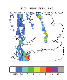
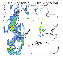
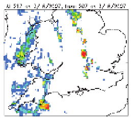
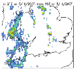
Fig. 6. A prototype Met Office NWP-based analysis (T+0 h) and T+1h, T+2h and T+3h
nowcasts of surface rain rate generated using 4D-Var assimilation with latent heat nudging
of the radar derived surface rain rates. All fields are valid at 2100 UTC on 3 June 2007. The
area of coverage is the full domain of the prototype NWP-based nowcasting system. Note
that dry areas are represented by the colour white.
Nonetheless, since this comparison is a first attempt without optimization of the data
assimilation scheme and without the exploitation of more frequent conventional and
Doppler radar measured radial wind observations, this is a very promising result. The
forecast in the south-west can be improved by assimilation of 15 minute time frequency GPS
water vapour data. At present, these are only available 90 minutes after data time so cannot
be used in a nowcast system. Work is underway to make the UK GPS data available closer
to data time.
Another potential source of water vapour information comes from radar refractivity by
exploiting the interaction of the radar beam with ground clutter. Work is underway with
Reading University to investigate the potential for obtaining this information from the UK
weather radar network.
Direct assimilations of radar derived surface precipitation rates within 4D-Var is being
investigated as well as direct or indirect assimilation of radar reflectivity, the latter through
derived temperature and humidity increments from external 1D-Var assimilation of
multiple beam elevations in vertical columns.