Image Processing Reference
In-Depth Information
5.3
Basic Objects, Attributes, and Planning Level
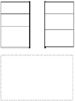
The implications of planned vs. unplanned urban development are shown in
Fig.
5.2
for a piece of vacant land that is urbanized over a period of time. Planned
development begins with site planning, land subdivision, and provision of infra-
structure. In this process, land is often cleared of much of its vegetation, and earth
works give rise to expanses of bare soil. Roads are constructed and surfaced, and
are generally easily discernible on remote sensing images as linear or area features
depending on the sensor's spatial resolution.
Thereafter, building construction commences,
which is followed by occupation and comple-
tion of landscaping. The process is often car-
ried out in phases (see Time 5 in Fig.
5.2
,
which shows the extension of the original site
local knowledge of urban
development processes is
crucial for the successful
extraction of urban data
from remote sensing images
PHYSICAL SITE DEVELOPMENT PROCESSES
Planned
Unplanned
Time
Vacant land
Vacant land
1
2
O-B
P-S
3
B-O
O-B
O-B
settlement
formation
4
B-O
B-
+
P-S-B
P-
+
O-B
5
servicing (road) &
settlement expansion
Fig. 5.2
A comparison of planned and unplanned site development processes