Image Processing Reference
In-Depth Information
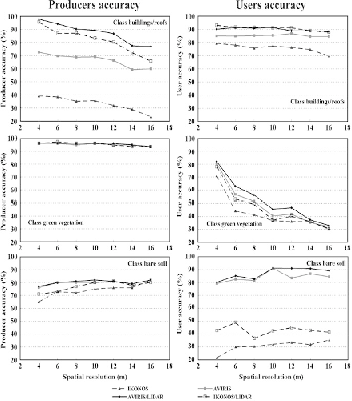
Fig. 4.7
Producer and user classification accuracies for three land cover classes and four different
sensor configurations with varying degraded spatial resolutions. All original sensor resolutions are
4 m with IKONOS four multispectral bands, the AVIRIS 14 most suitable bands, and the LIDAR
data with the difference between the first and the last response elevations
context and results in significant over-mapping of bare soil. In general, the results
of Fig.
4.7
indicate the importance of fine spatial resolution data for detailed map-
ping of urban land cover. This fact is emphasized in Fig.
4.8
, which shows the
overall classification accuracies and the KAPPA coefficients. Unquestionably, the
combination AVIRIS/LIDAR provides the best classification result with an overall
decrease of 11% from 4 to 16 m spatial resolutions. The decrease in accuracy from
4 to 16 m of the AVIRIS data is only 7%. For the combination of IKONOS/LIDAR,
on the other hand, this change is nearly 20% overall accuracy. At 16 m spatial