Image Processing Reference
In-Depth Information
4.7
Effects of Spatial Resolution and Three-Dimensional
Information
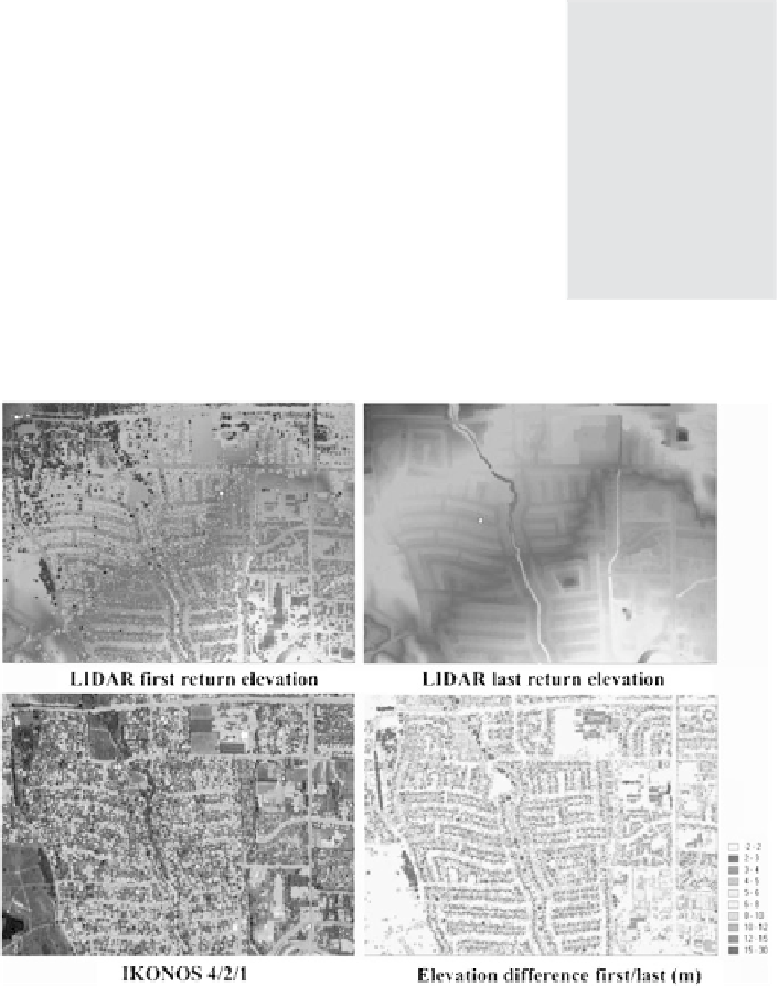
One approach for reducing spectral confusion between some land cover types would
be to incorporate a third dimension into the analysis. Urban areas have a distinct
three-dimensional structure that can be mapped with LIDAR systems (Jensen
2000
).
LIDAR (LIght Detection and Ranging) uses a laser pulse (usually in the NIR) to
measure the time distance from the sensor source to the
reflecting object. Based on the position of the sensor and
the pointing direction, the LIDAR signal can be used to
accurately calculate the three-dimensional position and
reflectance characteristics of the object. The LIDAR pulse
is first reflected on the top of the surface object (
first
return
) representing the object elevation (tree top or top of
buildings). The
last return
LIDAR signal is similar to the
first one if the surface is flat (e.g., parking lot). Differences
between first and last return appear if the sensed surface is
rough or the LIDAR beam partly penetrates through the
surface material, e.g., vegetation is partly transparent for
infrared radiation. In this case the
last return
elevation signal represents the ground
elevation in contrast to the first return that provides the surface signal (Fig.
4.6
). For
topographic
variations and
surfaces structure
can be incorpo-
rated in the
classification to
reduce the spec-
tral confusion
among urban
land cover types
Fig. 4.6
Examples of the LIDAR data (first and last response elevation and difference) compared
to IKONOS false color composite